


New Developments
 |
 |
“Environmental Laboratory has expanded its accreditation status with new parameters”
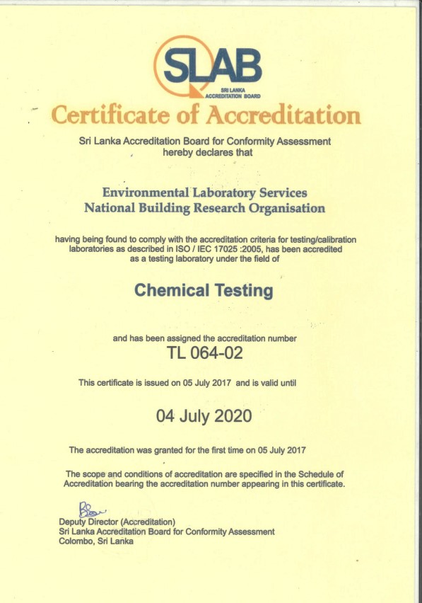
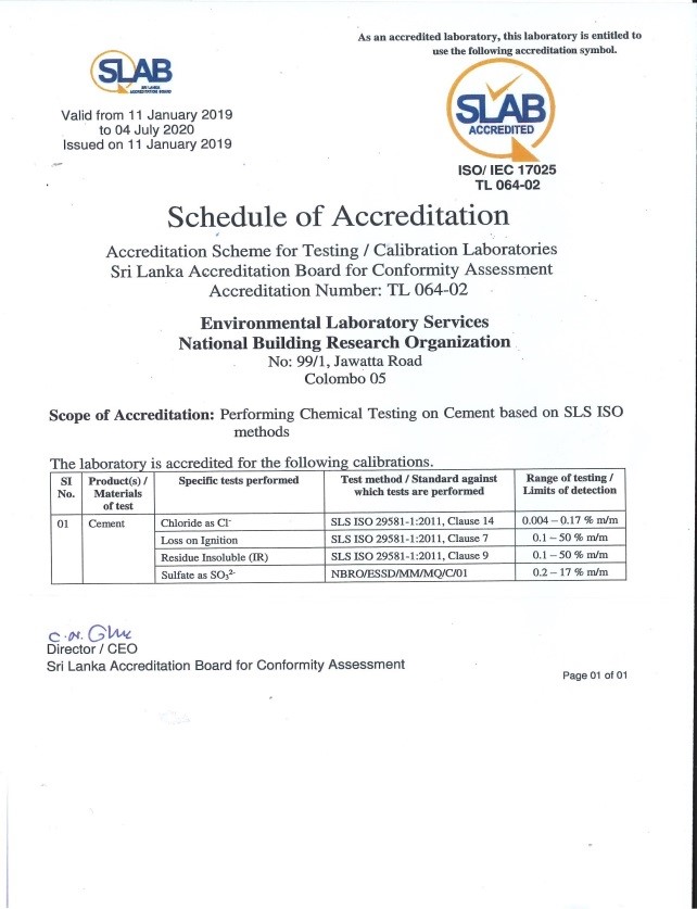
In 2019 with expanding our quality management system, the Environmental Laboratory Services has attained the accreditation status from SLAB (Sri Lanka Accreditation Board) for chemical tests on cement being the first chemical laboratory to achieve such international quality status under the lab reference no: TL064-02.
 |
 |
Projects
Development Projects under Government Funds- 2018
|
Category |
No. |
Project/Program |
|
Recurrent Expenditure |
1 |
Issuance of Landslide Risk Assessment Report /clearance certificates prior to building construction and development work in the landslide prone areas |
|
Capital Expenditure |
2 |
Expansion of Laboratories of NBRO |
|
|
3 |
Landslide Investigations, Research & Development |
|
|
|
|
|
|
|
|
|
|
|
|
|
|
|
|
|
|
4 |
Integrated Landslide Mitigation Project – Landslide Mitigation Program -stabilization identified landslide & unstable slopes on priority basis |
|
|
5 |
Development of a landslide risk profile |
|
|
6 |
Enhance real time landslide forecasting and early warning capacity by expanding Automated Rain Gauge network in Sri Lanka |
|
|
7 |
Enhancing Real Time Landslide Forecasting and Early Warning Capacity by Expanding Automated Rain Gauge Network in Sri Lanka |
|
Large Scale Investment Projects Planned |
1 |
Reduction of Landslide Vulnerability by Mitigation Measures |
|
|
2 |
Resettlement of High Risk Communities in Landslide Prone Districts |
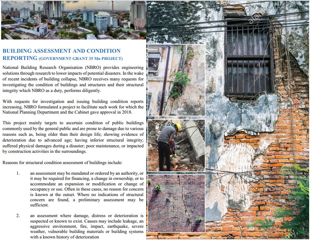
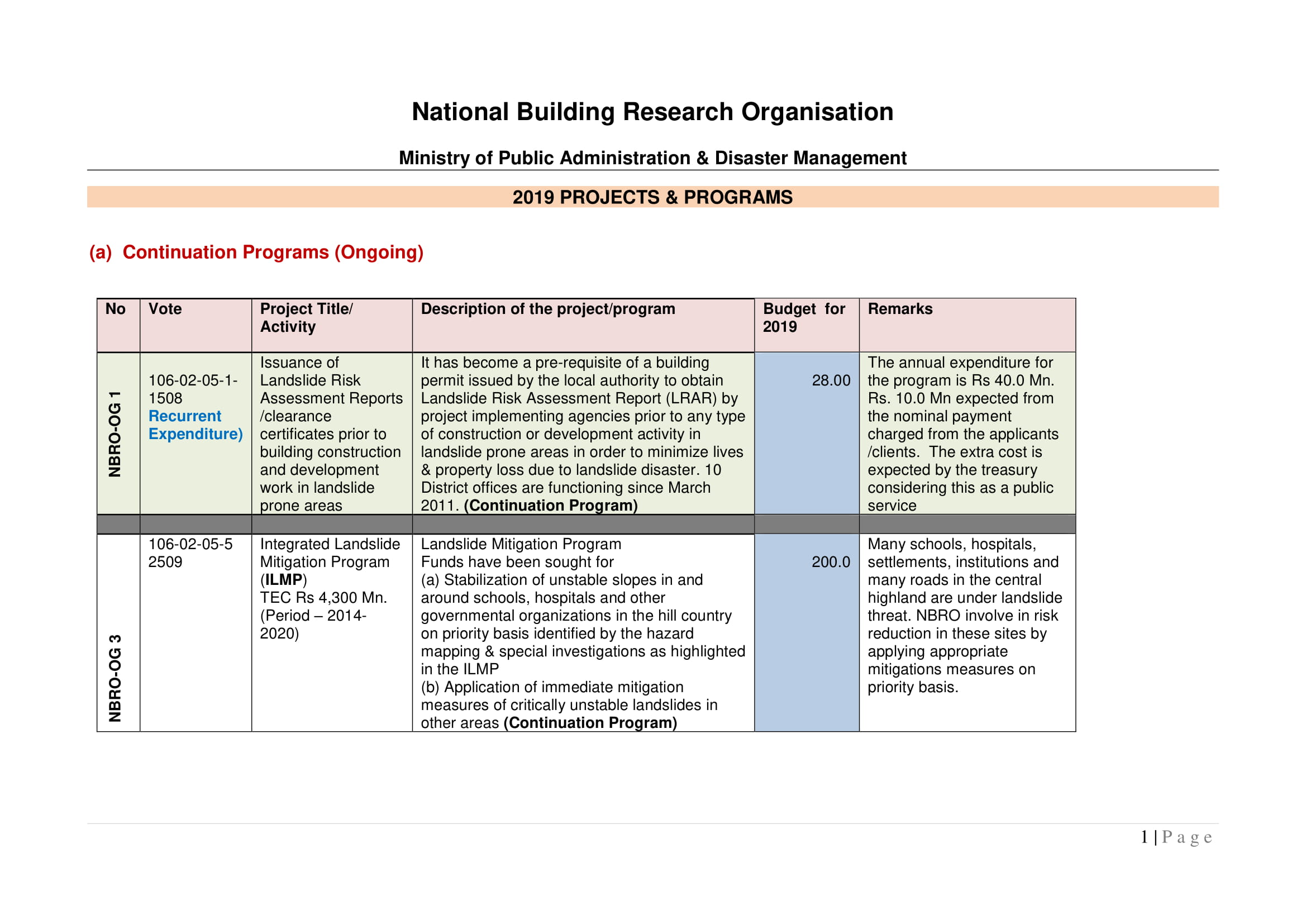
1.Issuance of Landslide Risk Assessment Reports prior to building construction and development work in landslide prone areas
Haphazard construction and development activities increase the risk of landslides and slope failures in the hill country. NBRO with the intention of lowering Haphazard construction and development activities in hazardous areas proposed to introduce a regulatory mechanism where NBRO will investigate a site and issue a report as a prerequisite before granting approval to a building permit by a local authority or a development project by a project approving agency. Cabinet Decision was taken in 2011 to authorize NBRO to issue such reports. In March 2011 NBRO established nine NBRO District Offices in landslide vulnerable districts to facilitate the issuance of such reports referred to as Landslide Risk Assessment Reports (LRARs). So far, over 67000 such reports have been issued to local government authorities and project approving agencies.
The General Treasury provided LKR 27.5 Mn in the year 2018 to supplement the recurrent expenditure of this issuance process, which is otherwise recovered by levying a nominal fee from applicants. The number of LRARs issued up to end of June 2018 is 3800.
2.Building project
NBRO laboratories were established over 30 years ago and since then many equipment and testing apparatus were added, rendering facilities in existing laboratories obsolete and spaces grossly inadequate. Existing buildings were renovated as much as permitted, but at one stage further expansion of laboratories and modernization became impossible. Hence the old buildings had to be demolished paving way to the construction of a new laboratory complex. Over 60% of the superstructure has been constructed by now.
3.Landslide Investigation, Research & Development
3.1 Landslide Hazard Zonation Mapping Project - Filling the gaps of Landslide Hazard Zonation Mapping - extended programme
Landslide Hazard Zonation Mapping Project (LHMP) is a project that NBRO continues from 1990. In this government-funded project, the spatial distribution of landslide hazard in the country is identified and hazard zonation maps have been prepared to 1:50,000 scale to cover almost all the landslide vulnerable areas of the country. Presently, updating of these maps are being done and in addition, high-resolution hazard zonation maps are prepared to 1:10,000 & 1:5,000 scales to cover the high-risk zones and development zones.
In the first 6 months of 2018, 9 hazard zonation maps to the scale of 1:10,000 have been prepared in Rathnapura and Kalutara districts and nearly 70% of the field verification is now complete. In addition, high-resolution hazard zonation map to the scale of 1:50,000 has been prepared for Rathnapura Municipal Council area and nearly 50% of field verification is now complete. The Government grant for the project in 2018 is LKR 20.0 Mn.
NBRO uses these maps in landslide early warning, landslide investigation, issuance of Landslide Risk Assessment Reports, and prioritization of potentially dangerous sites for mitigation. Various planning institutions use these maps in their planning activities. These maps are available for downloading free of cost in the NBRO website. Conducting awareness programs in landslide-prone districts to supplement this work in progress at present.
3.2 Research & Development Program for creating disaster resilience
NBRO conducts research in areas of its expertise. Often, research studies are conducted in collaboration with local universities, international research institutions, stakeholder institutions and interested parties from industry. NBRO usually holds a consultation session with the stakeholders to gather research interests and development needs. Such consultation was done at the beginning of 2018. NBRO decided to conduct major research work in the following areas.
- Design of a transitional shelter for disaster-affected communities
- Development of cost effective green masonry products using textile waste and coal fired oiler ash
- Development of alternative fibres to asbestos fibres for roofing materials
- Determination of regional and local rainfall thresholds for landslides in Sri Lanka
- Development of geotechnical guidelines for high-rise buildings
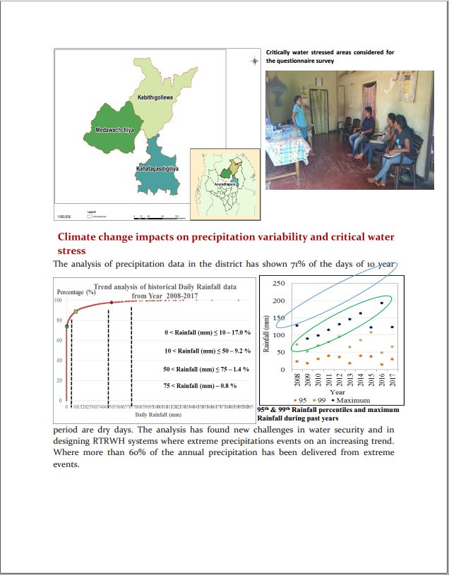
- Analysing the effect of meteorological, environmental and anthropogenic factors attributed to drought severity and sector-based water stress in Anuradhapura District
The government granted LKR 15.0 Mn for research and development in 2018 and these funds are effectively utilised in the research and development programme. Outcomes of this work will be presented and published at the next Annual Research Symposium of NBRO programmed for December 20185. Details of main Research & Development Projects are given under Research Areas in this website.
3.3 Landslide Special Investigations
NBRO conducts landslide investigations for the purpose of identifying risks in relation to neighbouring human settlements, infrastructure and plantations and to provide immediate recommendations to ensure the safety of life and property. These investigations are termed as Special Landslide Investigations and usually carried out as per the request of District and Divisional Secretaries, and officials of governmental or other institutions. Often the requirement for Special Investigation increases radically in extreme weather conditions, especially after a major landslide occurrence. In the first six months of the year 2018, a total of 1072 Special Landslide Investigations were performed. The General Treasury provided a total of LKR 20.0 Mn as funds for this work in this year.
3.4 Procurement of Research (Lab & Field) Equipment
NBRO receives an annual grant of LKR 25.0 Mn. from the General Treasury to procure laboratory and field equipment for research. This grant is effectively utilized to procure major equipment including field accessories for technical divisions and important IT related equipment. Procurement details of the year 2018 so far is given by the following table.
|
Division |
Procured items to this day in 2018 |
|
BMRTD |
Cement testing moulds |
|
ESSD |
pH meter, sample cooler |
|
GETD |
- |
|
Other divisions |
Computers, printers etc |
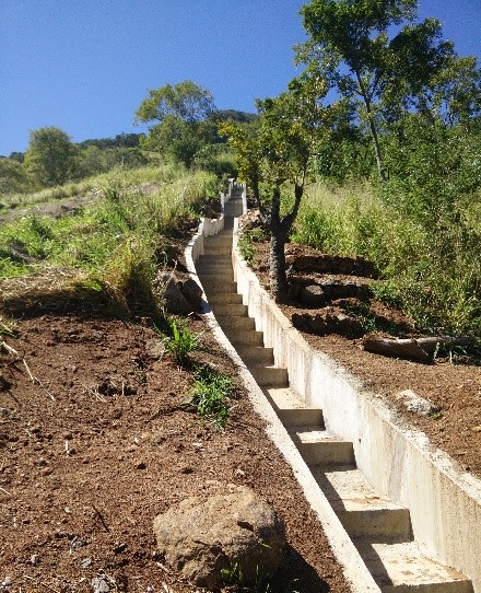
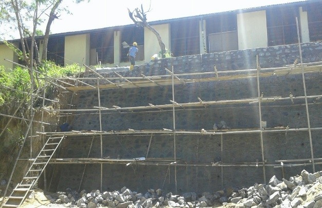
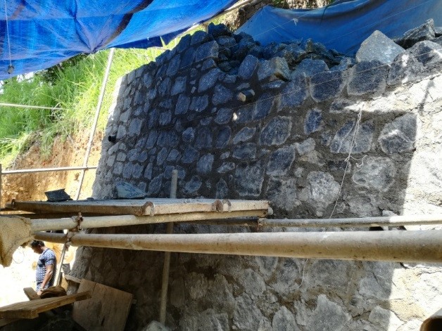
4.Landslide Mitigation Program
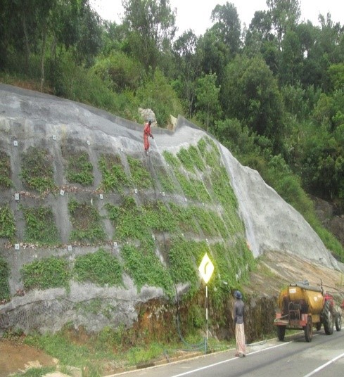
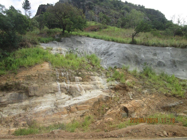
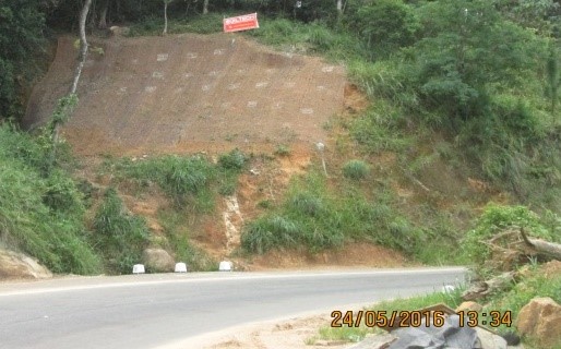
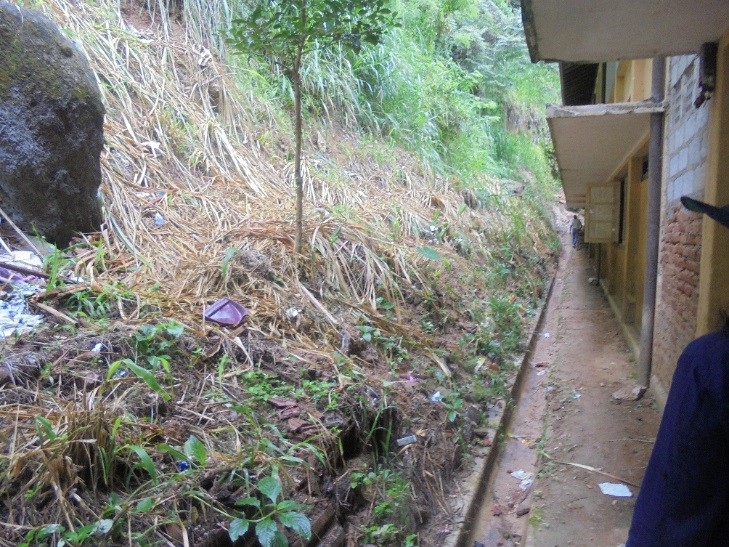
Stabilization of unstable slopes in and around schools, hospitals and other governmental organizations in the hill country on priority basis identified by the hazard mapping & special investigation.
Progress of landslide mitigation and slope stabilization projects up to the middle of year 2018 is indicated below:
- Lankagama Kanishta Vidyalaya
- Kadugannawa Tamil College
- Ayagama Hospital
- Atale Maha Vidyalaya, Baduraliya
5. Landslide Risk Profile Development
Landslide hazard maps delineate areas on the basis of landslide susceptibility and risk maps demarcate the potential of damages to human lives and property in a landslide. The proposed work in this project includes;
- Preparation of exposure maps of Kegalle, Ratnapura, Kalutara, Galle, Matara, Hambantota and Kandy districts in 1:10,000 scale, and data collection on elements at risk in Kegalle, Ratnapura, Kalutara, Galle, Matara, Hambantota districts
- Preparation of 1:5,000 scale land use and land form mapping in Nuwara Eliya MC, Bandarawela MC and Badulla MC Areas to formulate 1:5,000 scale landslide risk profiles.
- Community awareness prior to data collection on elements at risk in Kegalle, Ratnapura, Kalutara, Galle, Matara, Hambantota and Kandy districts
NBRO implements the Landslide Risk Profile Development Project with the financial assistance from Government of Sri Lanka. As an outcome of the project risk profiles and risk maps will be prepared by NBRO to enhance the capacity of national and sub-national level agencies in assessing the disaster risk and formulate short, medium and long term disaster risk reduction decisions. Risk mapping in Badulla district is complete and risk mapping in other landslide-prone districts continues. View: Landslide Risk Profile Development Project: Progress Report 2018
6.Installation of community-based landslide early warning systems – Phase I
Several key project components were identified and carried out to complete this project. These are:
- Educating and making aware the communities;
- formulating community-based preparedness plans and setting up site specific automated landslide early warning systems (with rain gauge, extensometer and moisture sensor coupled with siren and automatic communication system) in identified potential landslide areas in Badulla and Nuwara Eliya districts with a view to enhance the confidence and safety of the people living in those areas; and
- Expanding the distribution of manual rain gauges with threshold levels marked to all communities living in high risk locations and train communities on the use of manual rain gauges to take decisions for self – evacuation.
Most project activities have been completed by now and after the completion of distribution of more manual rain gauges in vulnerable areas the project will be completed by September 2018. With successful implementation of this project, NBRO envisages in continuing this project as Phase II and proposals to this effect have been formulated and submitted for approvals.
7. Enhancing Real Time Landslide Forecasting and Early Warning Capacity by Expanding Automated Rain Gauge Network
in Sri Lanka
NBRO presently uses a network of automated rain gauges in landslide early warning. Over 150 of these stations installed at identified locations are now working in the automated rain gauge network and it is expected that about 155 stations will be connected to the network by the end of 2018. These rain gauges transmit rainfall data to computers at NBRO and staffs of NBRO use this data in simulation and prediction of landslide scenarios. This project is beneficial to the rural communities living in vulnerable areas. The network will have 51 gauges installed with the funds from the General Treasury and other gauges donated under various projects by the UNDP, the World Bank (GFDRR) and Norwegian Geotechnical Institute. View: Rain Gauge Location Map
Rain Gauge Locations
|
District |
Number of Automated Rain Gauges |
|
Badulla |
31 |
|
Colombo (Reference Point) |
1 |
|
Galle |
7 |
|
Gampaha |
- |
|
Hambanthota |
3 |
|
Kalutara |
7 |
|
Kandy |
22 |
|
Kegalle |
14 |
|
Kurunegala |
3 |
|
Matale |
7 |
|
Matara |
10 |
|
Monaragala |
3 |
|
Nuwara Eliya |
26 |
|
Ratnapura |
21 |
Projects With Foreign Collaboration
Having a vision to create a disaster resilient country, NBRO carries out disaster risk reduction projects regularly. When necessary NBRO seeks the assistance of foreign institutions to improve its technical capabilities and in addition, frequently implements cooperation and collaboration projects with foreign institutions in the technical fields of mutual interest. As a result, NBRO has many on-going foreign collaboration projects in hand and also, has several proposals submitted to authorities awaiting approval. Description of on-going projects, proposed projects and recently completed projects are given below,
On-Going Foreign Collaboration Projects
- Technical Cooperation for Landslide Mitigation Project (TCLMP) PHASE II
- Projects of Climate Resilience Improvement Program (CRIP)
- NBRO – Norwegian Geotechnical Institute Technical Cooperation Project
- NBRO – DOHA Project
Proposed Foreign Collaboration Projects
- NBRO - International Consortium of Landslides Technical Cooperation Project
Foreign Collaboration Projects recently completed
- Technical Cooperation for Landslide Mitigation Project (TCLMP) PHASE I
- NBRO – Asian Disaster Preparedness Centre Technical Assistance Project
- NBRO – Vanderbilt Institute for Energy and Environment Technical Cooperation Project (ADAPT-SL)
- NBRO-UNDP Technical Cooperation Project for Enhancing Real Time Landslide Forecasting and Early Warning Capacity of NBRO
On-Going Foreign Collaboration Projects
Technical Cooperation for Landslide mitigation Project [TCLMP] – Phase II
NBRO at present is implementing the Phase II of the TCLMP in cooperation with Japanese International Cooperation Agency (JICA) and it is anticipated that this project will continue in the next three years. Teams from Japan visited NBRO to hold discussions on project implementation plan. Strengthening non-structural mitigation capacities will be the main focus of this project and some emphasis will be paid to structural measures as well.
Projects of Climate Resilience Improvement Program [CRIP]
Climate Resilience Improvement Project (CRIP) is a joint effort of Government of Sri Lanka and World Bank with the hopes of reducing the adverse impacts of climate change in the country and adopting to the stock of infrastructure to extreme climate shocks. The Project as a whole is being executed by Ministry of Irrigation and Water Resources Management (MIWRM) with the financial assistance of International Development Association (IDA) – World Bank. A main component (ensuring the transport continuity – CRIP Road Project), and a subprogram (CRIP School Protection Program) of the Project is being implemented by National Building Research Organisation. The Project is executed in two phases.
CRIP Components Implemented by NBRO
-
CRIP Transport Continuity Project
-
School Protection Subprogram
-
CRIP Provincial Road Project – Uva Province
CRIP Transport Continuity Project
Project Background
The Road Development Authority (RDA) implements the Transport Continuity Project component of the CRIP Project, which includes the stabilization of landslides and slope failures observed along several selected roads. Therefore, National Building Research Organisation (NBRO) as the national focal point in landslide disaster management, was entrusted to (i) investigate the sites affected by landslides or slope failures along the selected roads, (ii) design structural measures to stabilize the investigated unstable sites, and (iii) to supervise the implementation of designed stabilization measures.
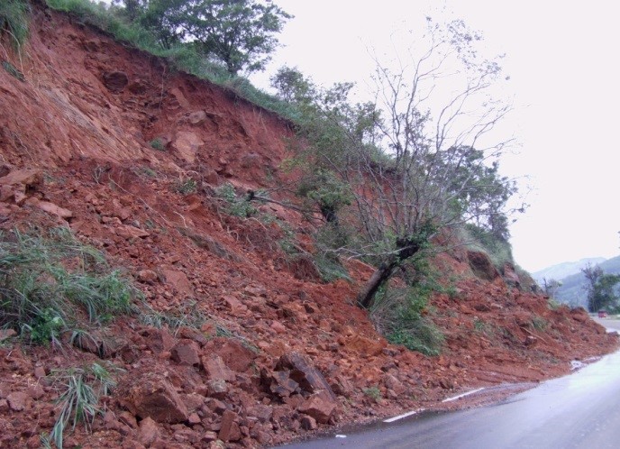
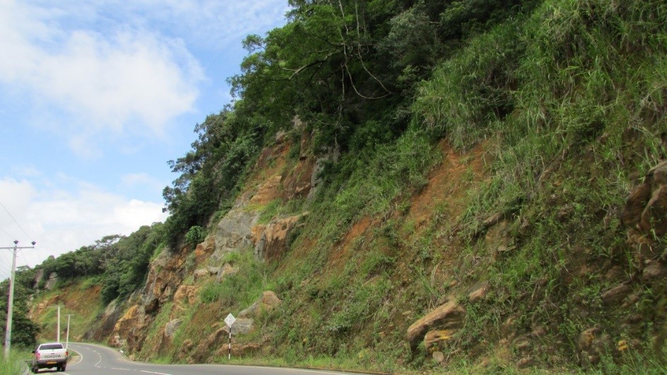
During the recent years the country has observed an increased trend of occurring landslides and according to the NBRO’s records, most of the recent landslides are associated with the slope cuts along the sides of the roads in hilly areas. Landslides at Paradeka along Kandy – Gampola road, Between culverts 50/2 – 50/50 along Thennekumbura - Ragala road, landslide at Moragahamula on Kandy - Mahiyangana road, landslide at Nuwaraeliya – Welimada road and the rock fall threat on Beragala - Wellawaya road among many. During the rainy seasons, the road users are frequently interrupted by the sudden road closures while facing a risk on their lives as well. The interruptions to transportation often cause negative impacts on the livelihoods, health, education, and economy of the country.
NBRO’s 30 years’ experience in executing landslide disaster risk reduction measures and related studies has paved the way to undertake the investigations, designing and supervision of slope stabilization along the roads selected under the Transport Continuity project. NBRO is currently involved in investigating, designing and construction supervision of the landslides observed along the following roads:
- Landslides along the Kandy - Mahiyangana – Padiyathalawa road (A026)
- Landslide at Haggala along the Peradeniya - Badulla – Chenkaladi road (A005)
- Landslide at Ginigathhena along the Nuwara Eliya – Hatton road (A007)
- Landslide at Beragala (Mahagalagawa) along the Colombo – Ratnapura Wellawaya road (A004)
- Landslide at Beragala along the Colombo – Ratnapura Wellawaya road (A004)
- Landslide at Kithulgala along the Awissawella – Hatton Nuwara Eliya road (A007)
- Landslide at Kaluaggala along the Colombo – Ratnapura Wellawaya road (A004)
 |
 |
| Landslide along Hanguranketha – Ragala road | Landslide along Kandy – Gampola road at Paradeka |
 |
 |
| Landslide along Nuwaraeliya - Welimada road | Landslide along Kandy – Mahiyangana road |
A few of the roadside landslides occurred during the recent years
Current Progress
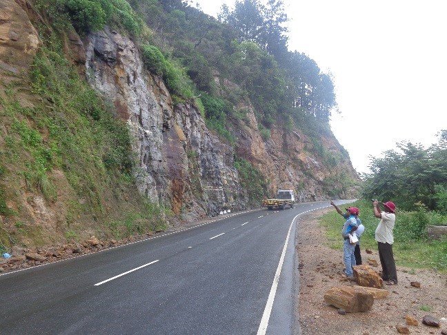
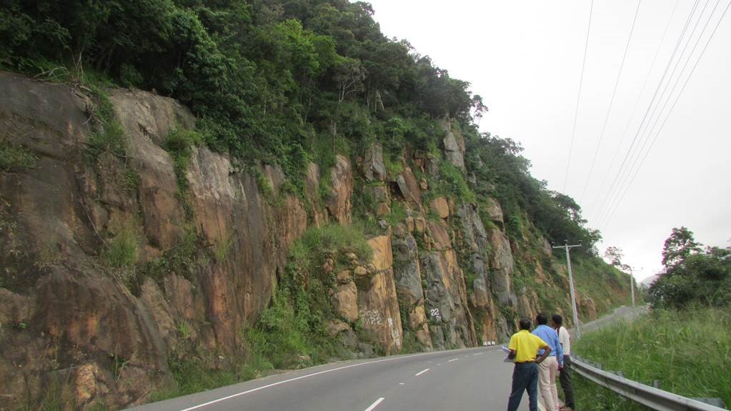
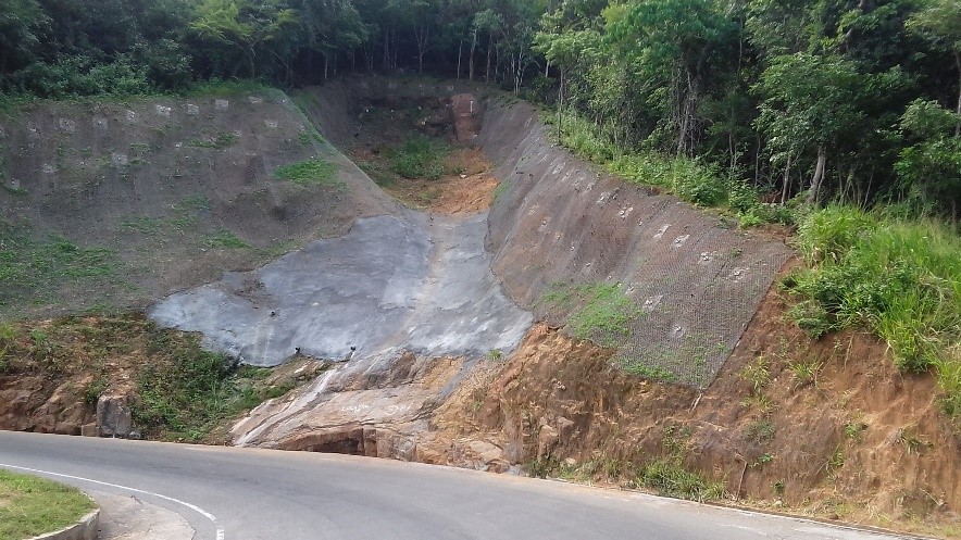
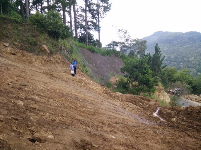
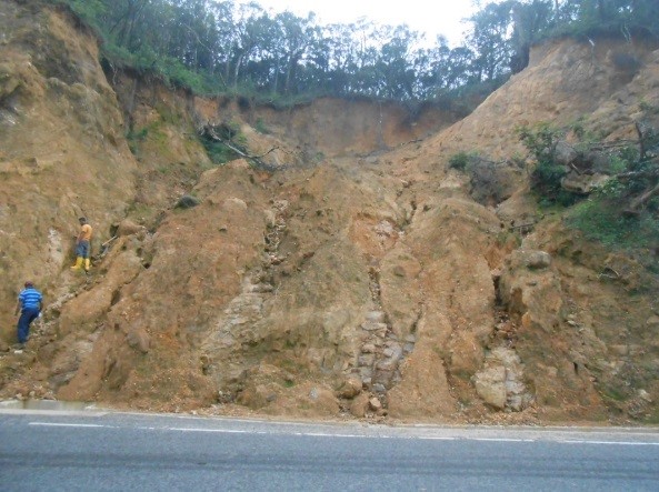
Landslides along the Kandy - Mahiyangana – Padiyathalawa road
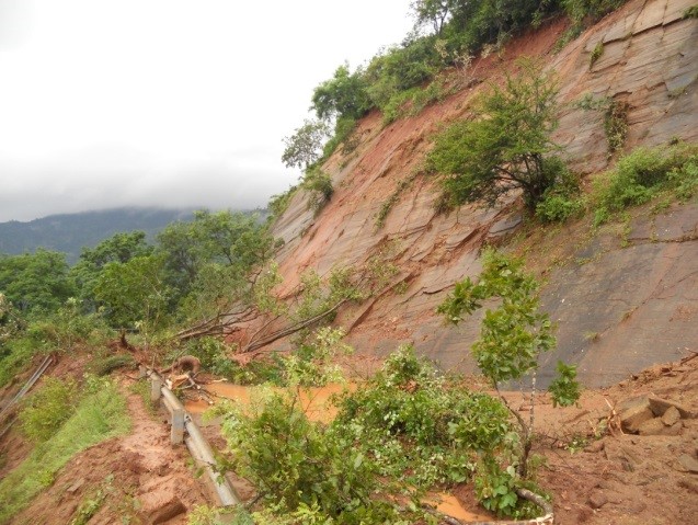
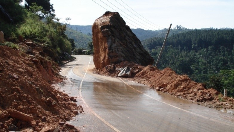
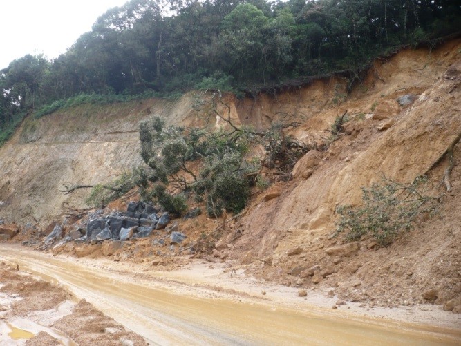
Landslides, rock failures and cut failures along the Kandy - Mahiyangana – Padiyathalawa road have been of a constant threat and source of headache to the road users over the past years. By considering the national interest and as per the request made by Road Development Authority (RDA), National Building Research Organization (NBRO) has investigated the affected areas and identified appropriate mitigation measures to minimize the associated risks.
 |
| One of the locations with high threat of rock fall before mitigation |
 |
| Rock fall observed at one location between culverts 55/3 and 55/6 |
 |
| Slope failure observed another location between culverts 55/3 and 55/6 |
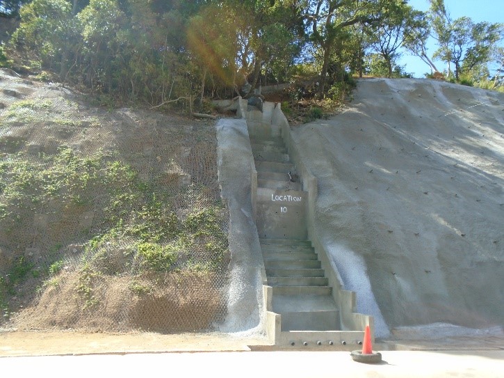
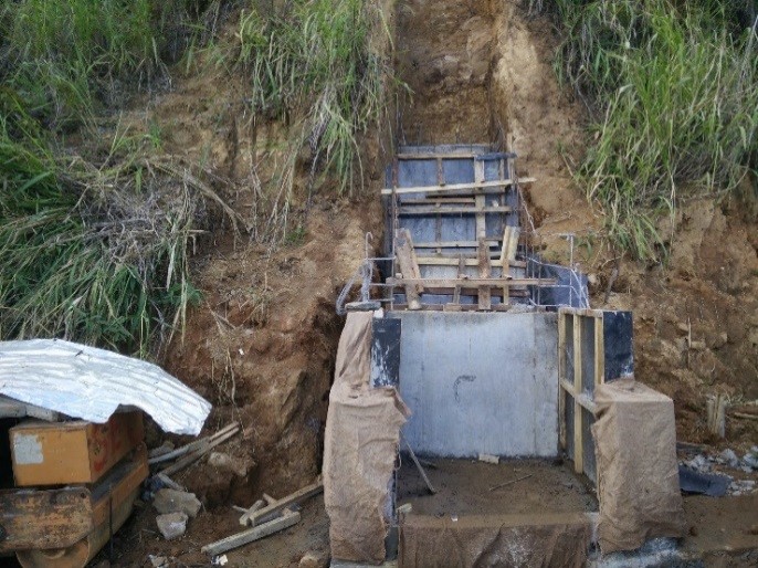
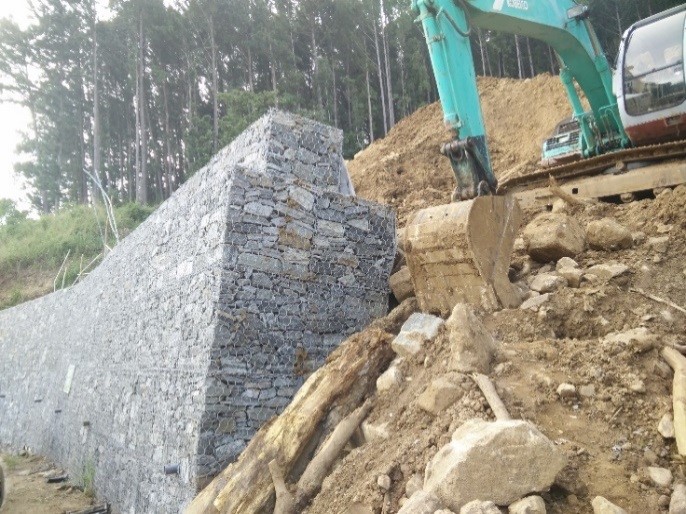
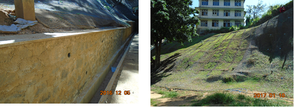
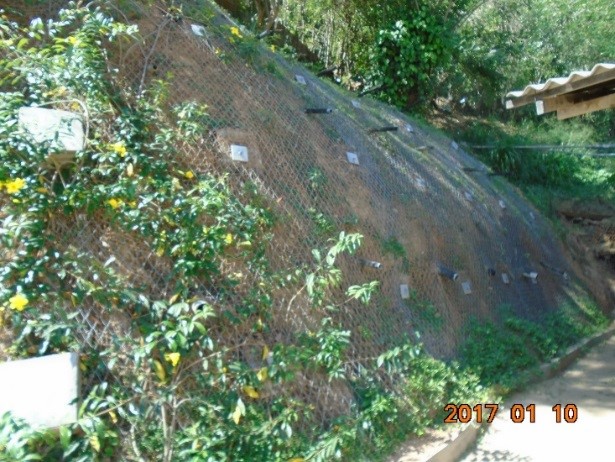
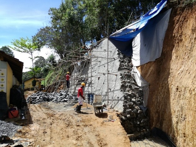
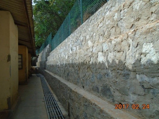
Altogether 18 locations were selected for rectification work along the Kandy – Mahiyangana -Padiyathalawa road. The mitigation works included soil nailing, retaining wall construction and drainage improvement. Mitigation work at 17 of these locations are completed while the construction work are still being carried out at Location 8. This project has successfully increased the safety of the road users as well as reducing the constant disruptions due to closure of different sections of the road due to cut slope failures and rock fall threats.
Mitigated locations
 |
 |
 |
 |
 |
 |
Mitigation works in progress
 |
 |
 |
 |
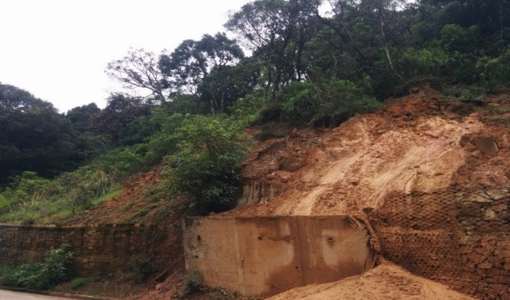
Haggala Landslide
 |
| Tilted wall by the Nuwara Eliya - Badulla road in between culvert 75/6 and 75/7 |
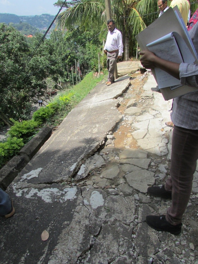
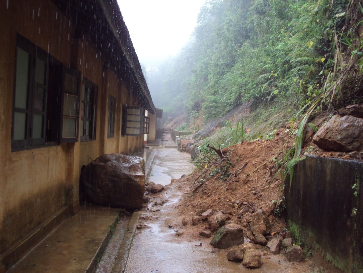
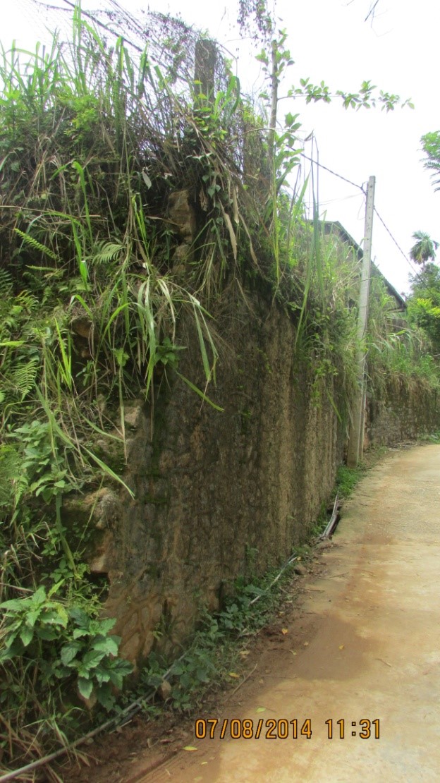
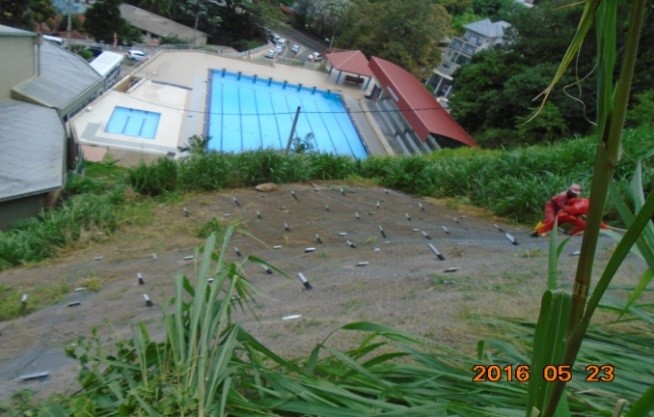
Several landslides have taken place along the Budulla – Nuwara Eliya main road between Culverts 75/5 and 76/5. The location is in close proximity to the Haggala Botanical Garden. These locations are identified to have a very high possibility for further failures. Therefore, appropriate stabilizing measures are to be adopted at these locations to ensure that further progressive failure is prevented and safety margins of all existing slopes are enhanced to an acceptable level.
 |
 |
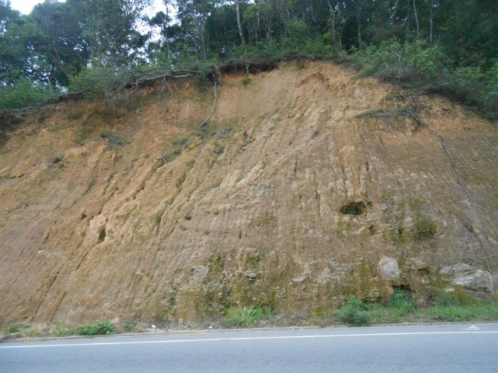
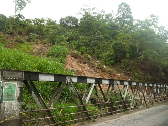
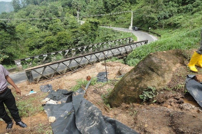
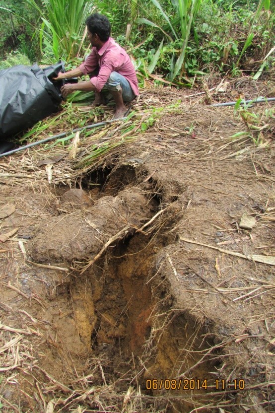
Ginigathhena Landslide
Numbers of cutting failures have been occurring at the no. 48/2, near Ginigathhena area at Avissawella-Hatton-Nuwara Eliya Road (A007), affecting the transportation activities. Further, a mass movement had occurred on 22nd June 2014 followed by the excavation works at the toe of the soil slope in question. Further, it was reported that there was no rain at the time of failure, but it has been further activated with continuous heavy rain received later into the area. In order to prevent further failures and obstructions to one of the major transport routes in the country, this location was selected to be mitigated under the Project.
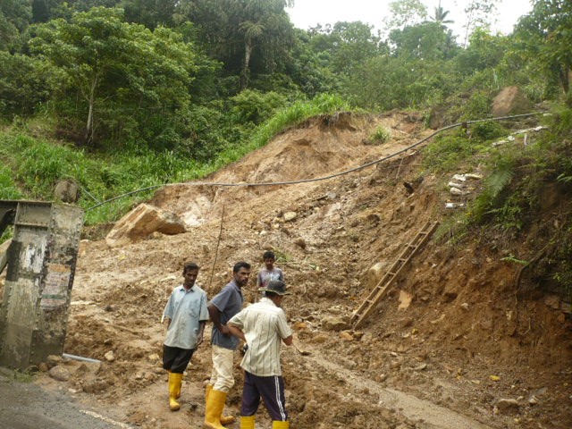 |
 |
Just after the landslide on 2014
 |
 |
Unstable boulders on landslide body and tension crack and the scar at the top
School Protection Program
Project Background
Since 1986, the government of Sri Lanka has undertaken various preparedness and mitigation measures to minimize the landslide disaster risk in the central highlands of Sri Lanka. Landslide hazard zonation mapping, regulation of landuse and development activities in hilly terrains, capacity building of stakeholder agencies, public awareness and education can be highlighted among such measures implemented and carried out by the Government through National Building Research Organisation (NBRO).
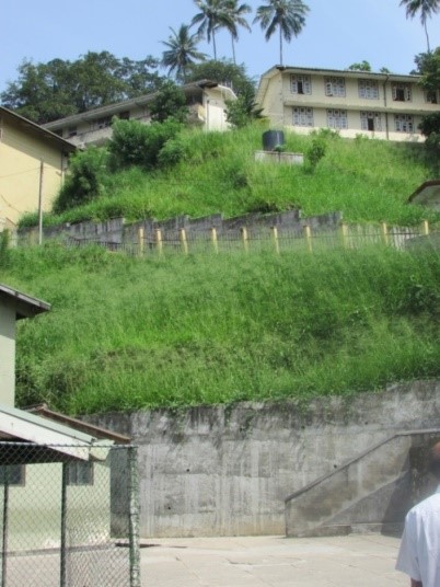
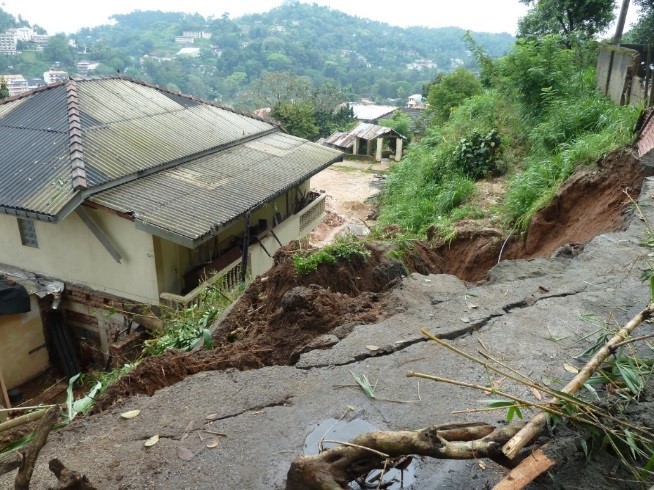
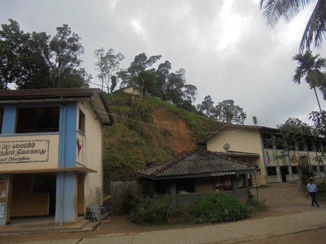
During the recent years of 2003, 2007, 2010 and 2011, several schools in the Central Province had been affected by landslides and slope failures causing trauma among the school communities as well as the concerned general public. In the light of this situation, in February 2011, NBRO submitted to the government a proposal for mitigation of the most critical landslides in the hilly districts. The proposal also emphasized the need for mitigation of 30 locations where schools are affected by landslides including 18 schools in the Kandy district, 06 schools in the Matale district, and another 06 schools in the Nuwara Eliya district.
A number of those schools identified in NBRO’s year 2011 proposal were repeatedly affected by landslides during the rainy seasons in successive years also. Considering the landslide threat on the lives of thousands of young children, school staffs, parents, and related many others, there was an urgent need of mitigating the landslides located in the above mentioned school premises. Therefore, NBRO and the Ministry of Disaster Management separated out the issue on the landslide risk reduction in schools and submitted a new technical proposal in the year 2013. Considering the high cost involved, rectification of landslides in school premises was proposed to be carried out in a phased out approach, and under the technical proposal submitted, “Mitigation of Landslide Impact on Schools in the Kandy District” is addressed.
In October, 2013 NBRO was informed by the Government of the acceptance of NBRO’s proposal for Mitigation of Landslide Impact on Schools in the Kandy District for funding by the World Bank under the School Protection project of the Sri Lanka Comprehensive Climate Risk Mitigation Program.
The School Protection Program is a $7 million investment on 18 schools from Kandy district identified to be highly vulnerable to landslides threat (benefiting approx. 30,000 students). This project is expected to address the occasional interferences to the education these schools have to face annually during the rainy seasons.
|
No |
Name of the school |
District |
Education Zone |
Education Division |
|
1 |
Dharmaraja College |
KANDY |
KANDY |
GANGAWATA KORALE |
|
2 |
Mahamaya Girls' College, |
KANDY |
KANDY |
GANGAWATA KORALE |
|
3 |
Hillwood College |
KANDY |
KANDY |
GANGAWATA KORALE |
|
4 |
Gothami Girls' College |
KANDY |
KANDY |
GANGAWATA KORALE |
|
5 |
Galkanda Kanishta Vidyalaya |
KANDY |
KATUGASTOTA |
PUJAPITIYA |
|
6 |
Sri Piyarathana Maha Vidyalaya (Ananda) |
KANDY |
KATUGASTOTA |
HARISPATTUWA |
|
7 |
Bothota Maha Vidyalaya |
KANDY |
KATUGASTOTA |
HARISPATTUWA |
|
8 |
Haloluwa Navodya Maha Vidyalaya |
KANDY |
KATUGASTOTA |
HARISPATTUWA |
|
9 |
Sirimalwatta Maha Vidyalaya |
KANDY |
WATTEGAMA |
KUNDASALE |
|
10 |
Kurukuthala Maha Vidyalaya |
KANDY |
DENUWARA |
UDUNUWARA |
|
11 |
Wattegama Central College |
KANDY |
WATTEGAMA |
PATHADUMBARA |
|
12 |
Molagoda Sri Piyadassi Vidyalaya |
KANDY |
KATUGASTOTA |
PUJAPITIYA |
|
13 |
Vidyartha Vidyalaya & Primary School |
KANDY |
KANDY |
GANGAWATA KORALE |
|
14 |
Gampola Buddhist College, |
KANDY |
GAMPOLA |
UDAPALATHA |
|
15 |
Jinaraja Girls' College |
KANDY |
GAMPOLA |
UDAPALATHA |
|
16 |
Gampola St. Joseph Girls' College |
KANDY |
GAMPOLA |
UDAPALATHA |
|
17 |
Kasawatta Muslim Vidyalaya, |
KANDY |
KATUGASTOTA |
AKURANA |
|
18 |
Rambuke-Ela Muslim Vidyalaya |
KANDY |
KATUGASTOTA |
AKURANA |
 |
 |
| One of the affected slopes of Dharamaraja College | Subsided access road of Dharmaraja College |
 |
 |
| Catastrophic failure on February 05, 2011 at the upper school boundary of Hillwood college | Slope failure behind a school building in March 2011 at Galkanda Kanishta Vidyalaya |
 |
 |
| Damaged concrete wall behind a school building at Galkanda Vidyalaya | Tilted Random Rubble Masonry Gravity wall at Kurukuttala Maha Vidyalaya |
 |
 |
| Failed slope at the school upper boundary at Haloluwa Navodya Maha Vidyalaya | Unsafe cut slope at Kurukuttala Maha Vidyalaya |
 |
 |
Cutting failures and unstable slopes at Wattegama Maha Vidyalaya
 |
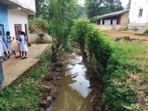 |
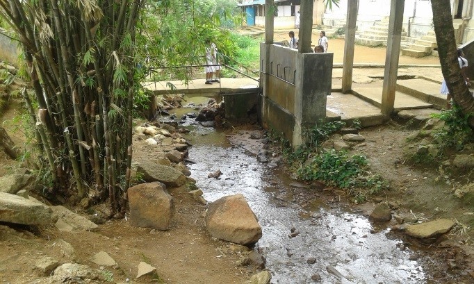
The stream running inside Jinaraja Balika Vidyalaya, which floods the school premise during rainy seasons
Rectification measures and current progress
Structural measures including retaining walls, soil nailing and drainage improvement have been proposed and designed for the schools under the Project in order to minimize the landslide threat to the life and property of the school communities and to ensure continued functionality. The 18 schools falling under the CRIP School Subprogram have been packaged and tendered under national competitive bidding, and the details of the packages as of 30th April, 2017 are as follows. The total project work is expected to wrap up by 31st, January 2018 with the successful completion of structural mitigation measures at the 18 schools.
|
|
Contract No. |
Name of the school |
Accepted contract amount (SLR, without VAT) |
Contractor |
|
1 |
CRIP/WORKS/NBRO/NCB/352 |
Dharmaraja College |
95,311,390.00 |
Soil Tech (Pvt) Ltd |
|
2,3,4 |
CRIP/WORKS/NBRO/NCB/351 |
Mahamaya Girls' College, Hillwood College and Gothami Girls' College |
127,624,310.00 |
Soil Tech (Pvt) Ltd |
|
5 |
CRIP/WORKS/NBRO/NCB/350 |
Galkanda Kanishta Vidyalaya |
36,929,849.00 |
ELS Construction (Pvt) Ltd |
|
6,7,8 |
CRIP/WORKS/NBRO/NCB/354 |
Sri Piyarathana Maha Vidyalaya (Ananda), Bothota Maha Vidyalaya, Haloluwa Navodya Maha Vidyalaya |
68,080,418.60 |
M/s George Steuart Engineering (Pvt) Ltd. |
|
9 |
CRIP/WORKS/NBRO/NCB/355 |
Sirimalwatta Maha Vidyalaya |
43,665,494.25 |
Newland Industries (Pvt) Ltd. |
|
10 |
CRIP/WORKS/NBRO/NCB/357 |
Kurukuthala Maha Vidyalaya |
19,951,393.13 |
Geo Engineering Consultants (PVT)LTD |
|
11 |
CRIP/WORKS/NBRO/NCB/356 |
Wattegama Central College |
84,196,577.25 |
ELS Construction (Pvt) Ltd |
|
16 |
CRIP/WORKS/NBRO/NCB/359 |
Gampola St. Joseph Girls' College |
Geo Engineering Consultants (PVT)LTD |
|
|
12 |
CRIP/WORKS/NBRO/NCB/350-1 |
Molagoda Sri Piyadassi Vidyalaya |
Tendering in progress |
|
|
13 |
CRIP/WORKS/NBRO/NCB/360 |
Vidyartha Vidyalaya |
||
|
14,15 |
CRIP/WORKS/NBRO/NCB/358 |
Gampola Buddhist College, Jinaraja Girls' College |
||
|
17, 18 |
CRIP/WORKS/NBRO/NCB/353 |
Kasawatta Muslim Vidyalaya, Rambuke-Ela Muslim Vidyalaya |
||
 |
 |
| Slope rectified with retaining structures and turning at Dharmaraja College | Slope rectification using soil nailing at Dharmaraja College |
 |
 |
| Slope safeguarded using soil nailing and Hydroseeding technique at Mahamaya College | Slope rectified using soil nailing at Hillwood college |
 |
 |
| Retaining wall construction in progress at Bothota Kanishta Vidyalaya | Retaining wall construction in progress at Sirimalwatte Maha Vidyalaya |
 |
 |
| Unstable slope protected using retaining wall and safety fence at Galkanda Vidyalaya | Retaining wall construction in progress at Haloluwa Navodya Maha Vidyalaya |
NBRO – Norwegian Geotechnical Institute Technical Cooperation Project
NBRO in collaboration with the Norwegian Geotechnical Institute (NGI) continues the project "Institutional Cooperation on Mitigation of Natural Disasters due to Climate Change".
Norwegian Geotechnical Institute (NGI) is a world-renowned geotechnical institute with extensive experience in global studies. NGI donated several automated rain gauges coupled with instruments to measure soil moisture, connected to the rain gauge network of the Landslide Early Warning System of NBRO. NGI donated Ground Penetration Radar (GPR) equipment to NBRO that is used by NBRO in ground subsidence studies. NGI also donated a latest camera drone and a state of the art computer with fast multiple processors for image processing to obtain the ortho-map & digital elevation models. This equipment is now used by NBRO in many applications ranging from landslide mapping, settlement mapping, land use mapping and other related work.
Some important studies and works that were completed during the recent past and now in progress are:
- trend analysis of ground subsidence in affected areas in Matale with the association of Geological Survey of Norway in the interpretation of INSAR satellite imagery and aerial maps
- conducting a study on the suspected oil contamination of ground water in Jaffna Peninsula together with a team of NGI experts
- conducting an aerial 3D mapping exercise with NBRO staff using a camera drone
- subsurface studies in Anuradhapura area with the assistance of senior NGI staff.
For more details please refer: NBRO Newsletter Vol 35 of October2016, Technical Co-operation for Mitigation of Natural Disasters Due to Climate Change in Sri Lanka).
NBRO – DOHA Technical Cooperation Project
NBRO expects carrying out a joint technical collaboration project with DOHA with the assistance provided by the Government of the Republic of Korea.
Proposed Foreign Collaboration Projects
NBRO - International Consortium of Landslides Technical Cooperation Project
NBRO is planning to implement the project "Development of Disaster Risk Reduction Strategy of Rain-Induced Rapid and Long-Travel Landslides in Sri Lanka") together with International Consortium of Landslides (ICL). ICL is an internationally known organisation based in Kyoto, Japan and having worldwide landslide institutions as members. NBRO is a member organisation of the ICL.
Japan Science and Technology Agency (JST) in collaboration with Japan International Collaboration Agency (JICA) develop project proposals through Science and Technology Research Partnership for Sustainable Development (SATREPS). In 2016, NBRO submitted a proposal on landslide risk management to SATREPS on instrumentation of hazardous landslides for slide detection and early warning. Later in 2017, NBRO together with the ICL submitted the initial proposal on "Development of Disaster Risk Reduction Strategy of Rain-Induced Rapid and Long-Travel Landslides in Sri Lanka" and subsequently in 2018, submitted the same proposal with certain revisions.
Irrigation Department, Department of Meteorology and Disaster management centre will be support agencies of this project and Central Engineering Consultancy Bureau and the universities of Moratuwa, Peradeniya and Ruhuna will be cooperating agencies. International Consortium of Landslides, Japan Agency for Maritime-Earth Science and Technology, Forestry and Forest Product Research Institute, Disaster Prevention Research Institute of Kyoto University and the universities of Niigata, Kochi, Teikyo Heisei and Toyama have joined as a consortium of collaborating agencies in Japan in this project.
The project team comprising of three high level members the ICL visited Sri Lanka to study long travel landslides together with local teams from 3rd July to 6th July 2017. Names of said team members are: Prof. Kyoji SASSA, Project Secretary, ICL; Dr. Dang Quang KHANG Research Promotion Officer, ICL and Dr.Kiyoharu HIROTA Researcher/Long-Term Expert, ICL.
Foreign Collaboration Projects recently completed
Technical Cooperation for Landslide mitigation Project [TCLMP] – Phase I
NBRO has been working in collaboration with Japanese International Cooperation Agency (JICA) in landslide risk management in the country for a considerably long period. JICA often extended their technical and financial assistance to NBRO. The technical assistance received from JICA became very important to NBRO especially through two recent projects namely Technical Cooperation for Landslide Mitigation Project (TCLMP) and Landslide Disaster Protection Project (LDPP), to which the Government of Japan provides both the technical and financial assistance through JICA.
Objective of the TCLMP is to enhance the capacity of NBRO in structural mitigation of landslides and of LDPP is the stabilization of unstable roadside slopes in the national highway network in the hill country done in collaboration with the Road Development Authority.
However, the landslide threat in the country is real and more counter effort will be necessary to lower landslide threat. Hence continuation of JICA assistance will be critical necessity. NBRO proposes to continue more projects with JICA collaboration and with JICA assistance in the future. Proposed activities in Phase II of TCLMP will address both structural and non-structural mitigation measures to counter landslide threat in the country.
Landslide Mitigation under TCLMP
In TCLMP, the JICA had an office at NBRO staffed with a team of Japanese technical experts in landslide risk management, of which some members were resident in Colombo whereas the others frequently visited Sri Lanka. The JICA experts under the leadership of Mr. Kenichi Handa, professional landslide engineer and expert from the Government of Japan, worked at NBRO Head Office and in the field. They designed and implemented the mitigation measures of four major landslides in Nuwara Eliya, Matale, Badulla and Kandy districts successfully. Financial and technical assistance of this project is given by the Japan International Cooperation Agency. They trained NBRO staff especially the geologists and geotechnical engineers. Implementation of planned mitigation measures is almost complete whereas post-project monitoring activities are now in progress. (For more details please refer: NBRO Newsletter Vol 37 of December 2016 Technical Co-operation for Landslide Mitigation Project; Aerial Survey)
Special reports published in TCLMP are available at the official website of the JICA Office in Colombo. Meeriyabedda Landslide Report;
NBRO – Asian Disaster Preparedness Centre Technical Assistance Project
NBRO will implement “Sri Lanka Community Landslide Risk Mitigation Project” (CLRMP) together with Asian Disaster Preparedness Centre of Thailand (ADPC) and Norwegian Geotechnical Institute of Norway (NGI). The World Bank will provide financial assistance for project implementation. This project will help in enhancing the capacity as well as unifying the efforts of NBRO and other stakeholder agencies in landslide disaster risk management, and in establishing a comprehensive framework and a long-term action plan.
NBRO -Vanderbilt Institute for Energy and Environment (VIEE) Technical Cooperation Project
NBRO’s collaboration with Vanderbilt Institute for Energy and Environment (VIEE) of USA started in 2010. The two institutions initiated a five-year study "Agricultural Decision-making and Adaptations to the Precipitation Trends in Sri Lanka" (ADAPT-SL) from 2012. Climate Research Unit (CRU) of NBRO was established to conduct related field studies. This project concluded in August 2017.
Project Brief: Water scarcity is a reality especially in the past few years to farmers in the North Central Province. They depend on either rain or irrigation water to grow paddy and find them challenged by this situation and understand that adaptation to new farming practices such as crop diversification is required without relying on traditional practices to manage water. Information gathered on farmer decision-making and perceptions of the challenges will be analysed to facilitate farmer decision making and making policy recommendations for the benefit of agricultural communities.
Click here for complete CRU Report on ADAPT- SL and refer: NBRO Newsletter Vol 36 of December 2016, Agricultural Decision-making and Adaptations to the Precipitation Trends in Sri Lanka (ADAPT-SL)
Related websites: Vanderbilt Institute for Energy and Environment, ADAPTSL
NBRO – UNDP Technical Cooperation Project for enhancing real time landslide forecasting and early warning capacity of NBRO
This project for establishment of automated rain gauge stations in pre-selected catchments was commenced in the year 2013 and continued. This project added 40 automated rain gauges to NBRO network.
NBRO Automated Rain Gauge Network
About 155 stations are connected and now working in the automated rain gauge network of NBRO for landslide early warning. This project is beneficial to the rural communities living in vulnerable areas. About 51 gauges were installed with the funds coming from the General Treasury and other gauges were donated under various projects by the UNDP, the World Bank (GFDRR) and Norwegian Geotechnical Institute. It is expected to increase this number to 175 by 2018.
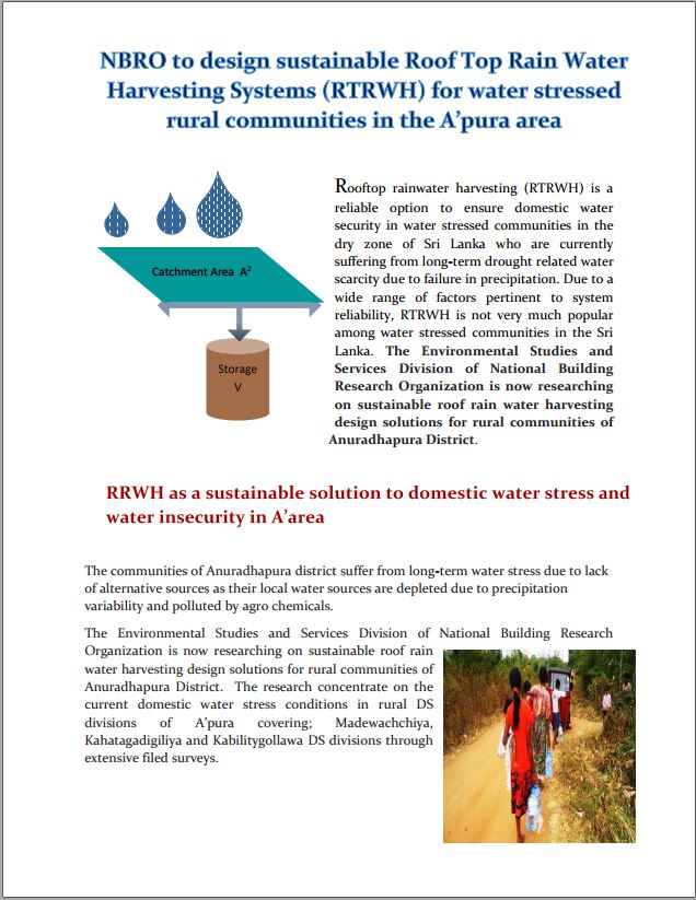
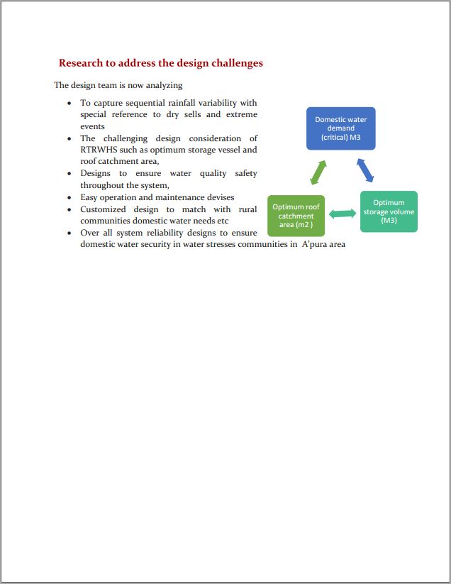
NBRO to design sustainable Roof Top Rain Water Harvesting Systems (RTRWH) for water stressed rural communities in the A’pura area


")