


Sri Lanka is recognized as vulnerable to climate change impacts, ranked 100th of 181 countries in the 2017 ND-GAIN Index. Unpredictable variability of rainfall patterns in the country could probably be due to global climate change with the increase in the frequency of extreme weather events. Floods, landslides, and drought are causing significant human, environmental, and economic losses which seriously affect the GDP of the country hence, there is an urgent need and essential requirement of reducing human and economic damages by managing these disaster risks in the country through early warning based on reliable rainfall prediction.
National Building Research Organisation (NBRO) is the national focal point for landslide risk management in Sri Lanka and has identified the value of precise measurements and the necessity of data point resolution on rainfall values for early warning. With its expertise, NBRO has designed a standard and durable, manual rain gauge with a 300 mm measuring capacity. The measurement of the amount of precipitation in a certain area over a period of time can be used from the household level to a wide range of uses; prediction of threshold water levels in farming, flood and landslide warning and etc.
The device is user-friendly for measures as the rain gauge design is adaptable and may be tailored to the client's needs, such as scale and instruction language is available at an affordable price with proper after-sales services.
Mr. R Ruhunuge
Scientist
Environmental Studies and Services Division
National Building Research Organisation
Office: 011-2588946 (Ext. 589), Mobile: 077-7190811
Email: This email address is being protected from spambots. You need JavaScript enabled to view it.
Geospatial & Intelligence Laboratory (GEOAi_Lab) at the National Building Research Organisation (NBRO) is making waves in the field of resilient and sustainable built environment. Under the astute leadership of Eng. (Dr.) Asiri Karunawardena, Director General of NBRO, the GEOAi_Lab comprises an impressive team of Geospatial and Remote Sensing Analysts, Cartographers, Visualization Experts, IT & Database Administrators, and Software Developers/Programmers, trained in geomatics, geography, statistics, computer science, and engineering.
The GEOAi_Lab's cutting-edge services have been garnering attention both locally and internationally. Among its remarkable offerings are drone-based geospatial data acquisition, processing, and analysis. Leveraging state-of-the-art drone technology, the team is able to collect precise geospatial data, providing critical insights for various projects.
In addition to drone-based data acquisition, the GEOAi_Lab specializes in remote sensing and satellite image analysis. This service has proved invaluable for environmental monitoring, disaster management, and land-use planning. By analyzing satellite imagery, they can identify patterns, trends, and potential risks, facilitating informed decision-making for sustainable development.
The GEOAi_Lab has also excelled in developing spatial databases and field survey applications using the Esri platform. The sophisticated database systems ensure efficient storage, retrieval, and analysis of geospatial data, while the field survey apps streamline data collection processes. These tools have significantly enhanced the planning and management of infrastructure projects and urban development initiatives.
One of the standout features of the GEOAi_Lab's capabilities is their expertise in spatial data visualization and reporting. By presenting complex geospatial data in clear and accessible formats, they enable stakeholders and decision-makers to grasp crucial information effectively. This visual approach enhances communication and understanding, driving more informed and efficient planning processes.
Moreover, the GEOAi_Lab has taken a proactive approach to land subdivision and layout planning for resilient settlement development. By combining their geospatial expertise with insights from other disciplines, they contribute to the creation of sustainable and disaster-resistant communities, safeguarding the well-being of residents and the environment.
Recognizing the significance of knowledge sharing, the GEOAi_Lab actively engages in training and capacity building in geospatial intelligence. Their commitment to fostering the next generation of geospatial professionals ensures a sustainable future for the field and drives innovation in urban planning and development practices.
The impact of the GEOAi_Lab's work reaches far beyond the borders of Sri Lanka. International collaborations and partnerships have enabled the organization to contribute to geospatial projects worldwide, addressing global challenges and enriching best practices in the domain.
To learn more about the exceptional services offered by the Geospatial & Intelligence Laboratory (GEOAi_Lab) at the National Building Research Organisation, interested parties can reach out to the Human Settlements Planning & Training Division at 99/1, Jawatta Road, Colombo 00500, Sri Lanka.
Telephone: +94 11 2588 946 Ext: 679
Chathuranga Kumarasiri, the Laboratory Manager, is readily available to assist with inquiries and provide further information about the GEOAi_Lab's endeavors.
With the GEOAi_Lab's continued dedication and expertise, the future of resilient and sustainable built environment development promises to be increasingly sustainable, innovative, and resilient.
National Building Research Organisation (NBRO) operating under the purview of Disaster Management Division of the Ministry of Defence, stands as a premier institute reputed for its work related to research, development, technical consultancy and testing services. Equipped with a skillful staff inclusive of many geologists, it is also the pioneering institute for landslide research and risk management in the country to date, and the Landslide Research & Risk Management Division (LRRMD) has been the powerhouse and driving force behind NBRO in the endeavor. Amongst the multiple tasks performed by NBRO in this regard are landslide hazard zonation mapping, field investigations, issuance of early warning, creating awareness, developing safe construction guidelines, landslide risk mapping, land-use planning, policies development and structural mitigation of landslides. In addition, the LRRMD also provides the unique service of performing all kinds of landslide investigations/risk assessments and issuing clearance for construction/development plans in landslide prone areas.
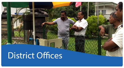
Over the last two decades, landslides have become the most prominent hazard in the central highlands of the country bringing about huge life and property losses. As a result, role of NBRO has become increasingly important, and the growing workload has made NBRO feel the need for an easily manageable, operational and documentation system. To cater the said requirement, an Information Management System by the name of LIMS (Landslide Information Management System) has been recently developed by the LRRMD. The system development was funded by JICA under project SABO which is a technical cooperation with the NBRO. The LIMS system which has already been implemented and in use, provides a digital platform that assists landslide inspection efforts by NBRO head office and ten district offices located in fourteen landslide-prone districts of Sri Lanka. Recently, many institutes have made great strides in removing or at least reducing the use of paper from their work-environment and the LRRRMD hopes to do the same with the help of LIMS. All the processes of the Inspection body from receipt of customers’ inspection requests to issuance of the inspection report are now facilitated electronically through the LIMS. It is helping LRRMD to streamline and accelerate its inspection system processes by making document and information access faster and easier, while cutting down time and money spent on document edition, redistribution, approval cycles, printing and storage spaces.
LIMS also facilitates detailed databases to input massive load of about 120,000 past landslide records in possession of NBRO, while ensuring the safekeeping of data and confidential information. This allows convenient data search options for research and progress monitoring, and an irrefutable track record for key decision making. Another important change brought about by LIMS is refining the decision making process associated with inspection work which was formerly dependent upon purely subjective qualitative judgement, into a more consistent semi-quantitative system by introducing necessary guidelines and criteria. The ultimate objective of LIMS is turning the LRRMD workspace into a smart office from which people can obtain hassle-free service without unnecessary delays, all while being at the comfort of their homes.
Furthermore, LRRMD is taking another step forward in elevating its inspection services, by seeking accreditation status from Sri Lankan Accreditation Board (SLAB) under ISO/IEC 17020:2012 standard for operation of various types of bodies performing inspections, the applicable standard for landslide risk assessment activities performed by the LRRMD. Accreditation is considered a reliable indicator of technical competence both nationally and internationally. Becoming accredited for its inspection activities will allow LRRMD to level up to recognized international standards. Amongst the benefits would be better recognition, enhanced professional and legal credibility, improved performance and smooth systematic operation of the Inspection Body. Over the years, customers from both private and state sector organizations has sought LRRMD inspection services based purely on trust and reputation with virtually no marketing or advertising strategies. Obtaining accreditation status will further assure LRRMD customers that the inspection reports supplied by the inspection service are transparent, punctual, impartial, accurate, and consistently reliable. With this added advantage of LIMS, the staff of LRRMD is now better equipped to serve inspection duties and dedicatedly working towards obtaining ISO/IEC 17020:2012 accreditation status within the year, so as to provide standardized first-rate inspection services of finest quality to its customers of state and private sectors.
Written By:
Ms. E.J.M.P.H. Jayasundara (Geologist)
Landslide Research & Risk Management Division
National Building Research Organisation