


- ඔබ මෙතැනය:
-
මූලය

- පුවත් සහ සිදුවීම්
“NBRO Collaborate with Local and International partners to Promote Community-Based Landslide Risk Awareness and Risk Management”

The National Building Research Organization (NBRO) has identified 84,071 buildings located in landslide susceptible areas through hazard zonation mapping, and over 15,000 houses arelocated in landslide high-risk areas that require resettlement. These families are currently inthe process of resettlement, yet a significant portion remains at high and medium risklevels.
To address this, the NBRO is planned to enhance community-based landslide riskmanagement capacity programs in partnership with local and international organizations,aiming i) to educate community about their current risk levels, including hazard,vulnerability, and capacity, ii) to provide strategies to reduce risk and enhance resilience andiii) to empower communities with knowledge and tools to make informed decisions duringdisasters.
As a pilot project, NBRO recently organized an awareness program in Hali Ela DSD, bringingtogether stakeholders from various sectors, including the Hali-Ela divisional secretariat,Disaster Management Center, Grama Niladari Officers, Save the Children organisation, andmembers of identified risk communities.
NBRO plans to extend this program across the landslides hazard prone districts initiatingfrom Subodagama, Mahawattegama, and Hapuwelakumbura communities in Hali-Ela DSD inBadulla District. Through these programs NBRO aims to build resilient communities that canindependently address landslide risks, ultimately creating a safer, more disaster-preparedsociety.


කරදගොල්ල - මලිත්තගොල්ල නායයාම හදුනාගත්තේ 2019 වර්ෂයේ…

පසුගිය දිනවල පැවති අධික වර්ෂාවත් සමග බදුල්ල දිස්ත්රික්කයේ ඇල්ල ප්රාදේශීය ලේකම් කොට්ඨාශයේ කරදගොල්ල ග්රාම නිලධාරි වසමේ මලිත්තගොල්ල ප්රදේශයේ පෙර හදුනාගෙන තිබු නාය ස්ථානයක නාය නැවත සක්රීය වීමේ ලක්ෂනයන් (නාය පාදම ආසන්නයෙන් මඩ සහිත ජලය ගලා ඒම) නිරීක්ෂනය වී තිබේ.
මලිත්තගොල්ල ප්රදේශයේ කුඹුරුයායක් ආශ්රිතව හදුනාගෙන ඇති මෙම නාය පලමුව 2019 වර්ෂයේදී සක්රීය වී ඇති අතර, 2023 වර්ෂයේ නොවැම්බර් මස මෙම නායයෑම නැවත සක්රීය වී නිවාස 13 ක් අධි අවදානම් ලෙස හඳුනාගෙන (2019 වර්ෂයේ නිවාස 8ක් සහ 2023 වර්ෂයේ නිවාස 5 ක්), එම පුද්ගලයන් වෙනත් සුරක්ෂිත ස්ථානයක පදිංචි කිරීමට ජාතික ගොඩනැගිලි පර්යේෂන සංවිධානය නිර්දේශ කොට ඇත.
මෙම නායයාම සක්රීය වීමත් සමග ඇල්ල - වැල්ලවාය ප්රධාන මාර්ගය නාය සුන්බුන් මගින් මීට ඉහතදීද අවහිර වීමටකට ලක් වූ බැවින්, මෙම නාය යලිත් සක්රීය වී යම් සුන්බුන් ගලනයක් ඇතිවුවහොත් ඒ මගින් ඇල්ල - වැල්ලවාය ප්රධාන මාර්ගය නැවතත් අවහිර වීමට අවදානමක් පවතී. ඒ හෙයින් වර්ෂා අවස්ථාවල මෙම මාර්ගය භාවිතා කරන්නන් මෙම අවදානම් තත්ත්වය පිළිබදව සැලකිලිමත් විය යුතුය.
මෙම නායයෑම් ස්ථානය පිලිබදව තවදුරටත් පරීක්ෂාකිරීම සදහා ජාතික ගොඩනැගිලි පර්යේෂන සංවිධානයේ විශේෂඥයින් පිරිසක් 2024 අප්රේල් මස අවසන් සතියේදී මෙම ස්ථානය නිරීක්ෂනය කිරීමට සැලසුම් කොට තිබේ. මෙමගින් නාය අවදානම් අවම කොට ප්රදේශයේ ආරක්ෂාව තහවුරු කිරීම සදහා අවශ්ය කෙටි කාලීන සහ දිගු කාලීන නාය ස්ථාවර කිරීමේ ක්රමෝපායන් හදුනාගැනීමට අපේක්ෂා කෙරේ.


Landslide Awareness Workshops, targeting officers in Aranayake Divisional Secretariate office and School Children, Aranayake under SATREP project
In a proactive effort to bolster disaster preparedness and community resilience, the National Building Research Organisation in collaboration with the Interanational Consortium on Landslides under SATREPS project activities organized a series of impactful awareness programs in Aranayake during late March 2024. These programs, held under the auspices of the SATREPS project activities, targeted both government officers and school children in the region, aiming to equip them with vital knowledge and skills to identify the risks associated landslides with the concept of town watching.
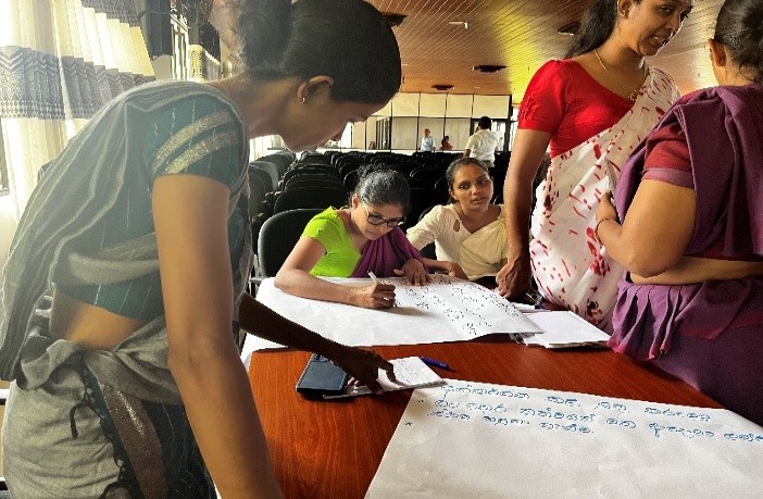
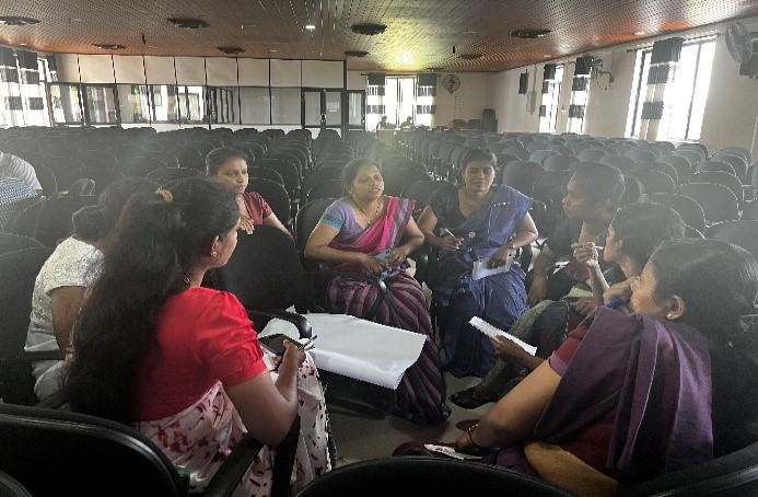
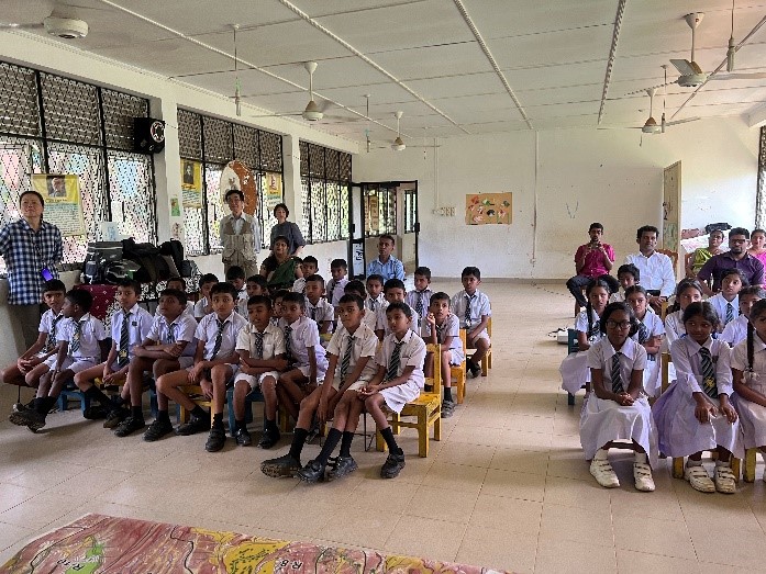
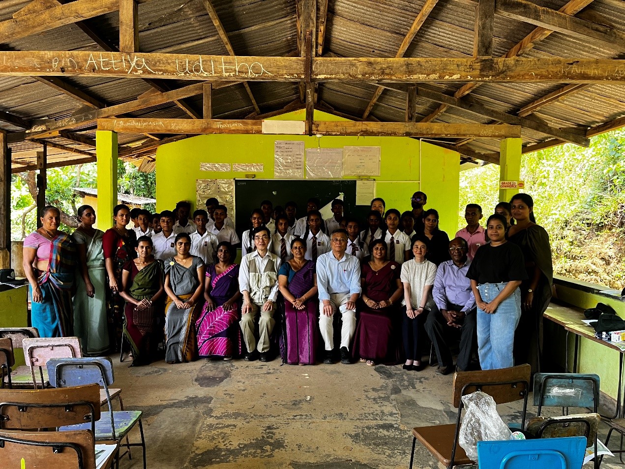
The initiatives commenced on March 26 at the Aranayake Divisional Secretariat office, where a comprehensive session was conducted with participating 39 number of government officers with the active participation of Mrs. Shamali Piyathissa, Divisional Secretariat (Aranayake DS office). The SATREPS Project introduction presentation was delivered by Dr Imaya Ariyarathna and that helped to familiarize all the participants with the ongoing and completed activities of the SATREPS project. Furthermore, the discussion session was carried out after the presentation and the one-day-ahead prediction of mountain rains and rain induced rapid and long travelling landslide (RRLL) occurrences timely to the last mile as augmented reality (AR) dioramas of the potential rains by prediction using Multi-Scale Simulator for the Geo-environment (MSSG) and RRLLs with a background map displayed and discussed clearly. The workshop was wrapped up with the group activity of suggestions for the AR software and this was successfully carried out with the four groups and their suggestions were presented at the end of the workshop.
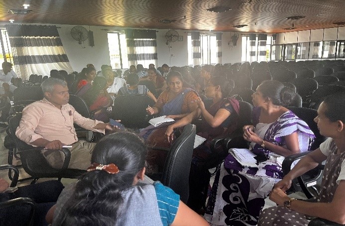
Figures : Photographs of, programs held on 26th March at Aranayake Divisional Secretariat office
Figure : Officers, from NBRO head office, LRRMD & Kegalle District Ofifice and ICL Japan experts, participated for the program with ICL tresure, Prof. Jagath Gunathilake and Disaster relief officer, Aranayake DS
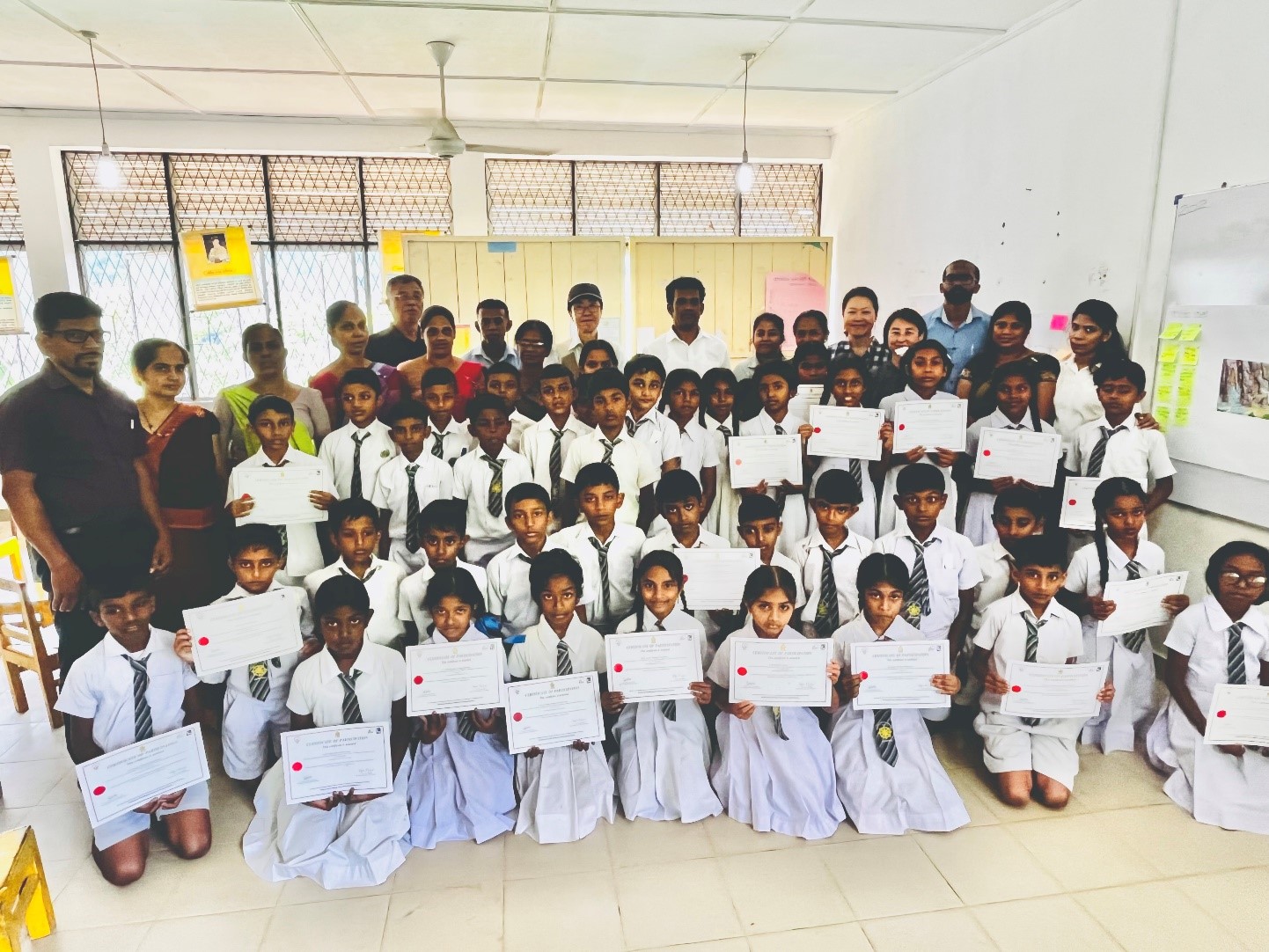
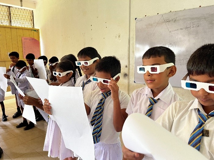
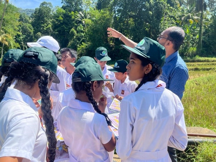
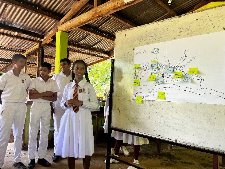
Building on the success of the initial session, interactive workshops were subsequently held at Hathgampola Primary School and Secondary School on March 27 and 28, with the participatipnts of Grade 5 and 10, respectively. The 60 participants participated in the primary school workshop and the 41 participants were in the secondary school workshop. The workshop was chaired by Dr. Imaya Ariyarathne Mr. Priyantha Bandara and Ms. Tania Munasinghe. The training programme of the town watching for teachers was firstly carried out. The introductory session and the Roleplay of the Aranayake landslides were presented to the students with the help of the ICL SATREPS Officers from Japan, Dr. Imaya Ariyarathne and Ms. Tania Munasinghe. The Town-watching field activities were carried out with the participation of four groups of students and teachers and this vital tool allowed students and teachers to identify the risk areas related to the landslides in their surrounding areas and the risk area map from the fieldwork was created and presented by the four groups at the end of the workshop. The participation certificates were given to every student who participated in the workshop. This workshop gave the excellent opportunity to engage master trainers (teachers) in educating pupils and coaching new trainers who are less experienced with disaster risk reduction education.
The programs garnered enthusiastic participation from both officers and students, reflecting the community's proactive stance towards disaster risk reduction. Attendees expressed their appreciation for the invaluable insights gained and commended the SATREPS project for its proactive approach to community empowerment.

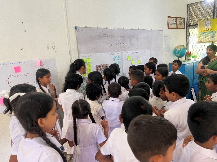
Figures 0: During the workshop held on 27th March at Hathgampola primary school for Grade 5 students
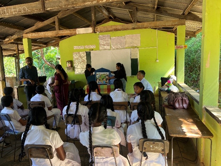
Figures : Photographs during the workshop held on 28th March at Hathgampola Secondary school for Grade 10 students
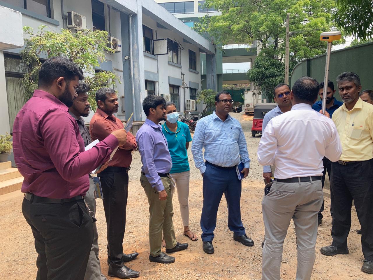
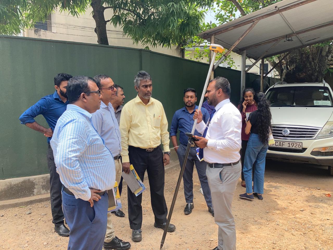
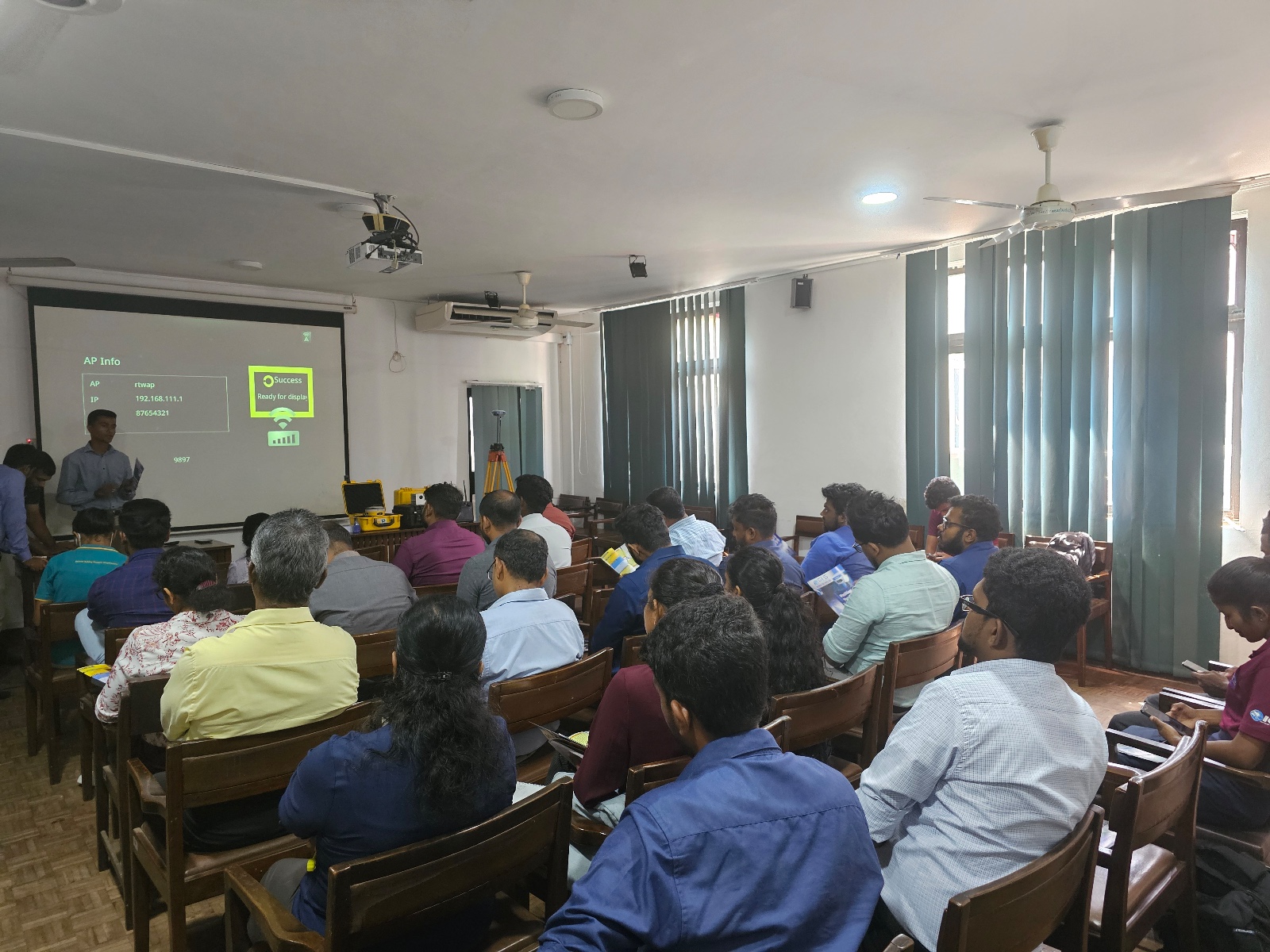
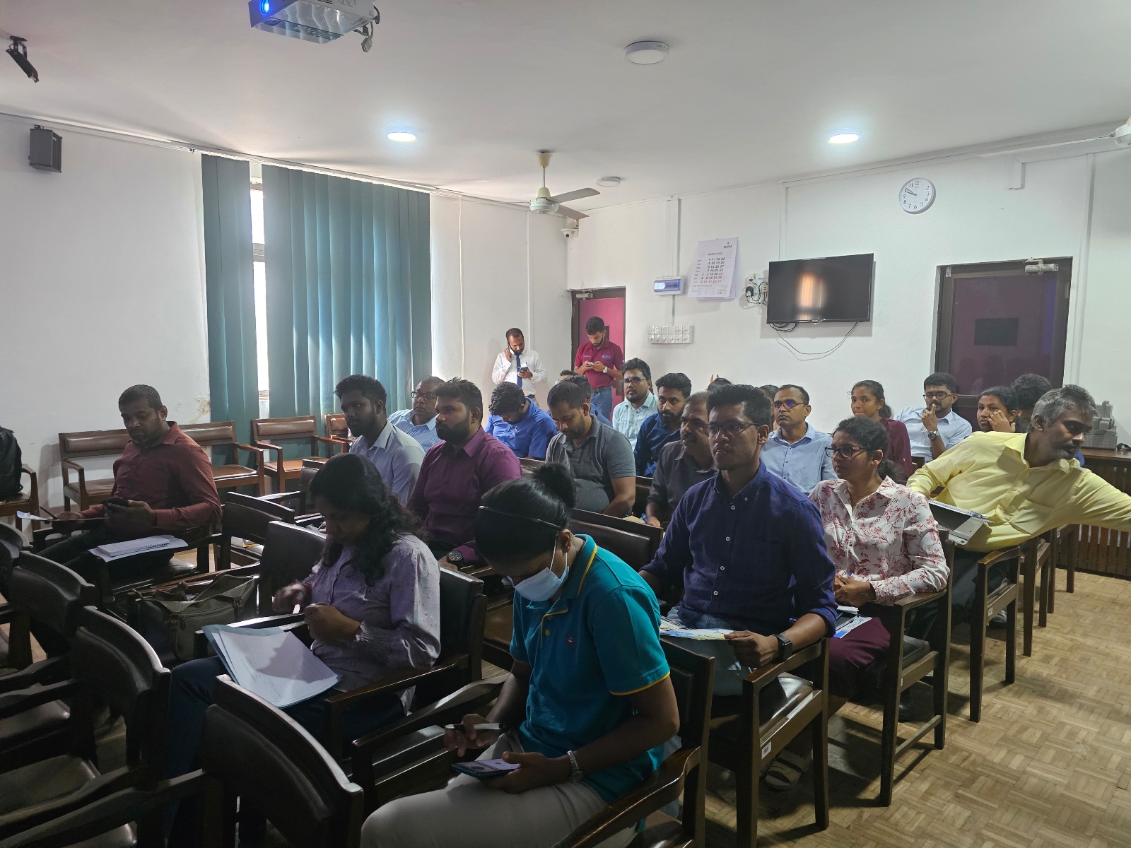
NBRO Scientists Elevate Expertise with Advanced Geospatial Training
Date: March 22nd, 2024
NBRO scientists recently joined a special training in collaboration with Global GIS Private Limited. Held on March 22nd, 2024, the workshop served as a platform, equipping participants with cutting-edge knowledge and practical experience in geospatial technologies.
The training covered various topics, including:
- GNSS technology for surveying and mapping
- Terrain modelling and mapping using drones (LiDAR, Photogrammetry)
- GNSS based building deformation monitoring technology
Beyond theoretical knowledge, the program provided scientists with valuable hands-on experience. This included capturing LiDAR point cloud data, processing it for analysis, and collecting field data using advanced GIS data collectors and specialized software.
This capacity development program empowers NBRO scientists with the latest geospatial tools and skills, enabling them to conduct their research and monitoring activities with greater efficiency and precision.