


- About Us
- Services
- Divisions
 Building Materials Research & Testing Division (BMRTD)
 Environmental Studies & Services Division (ESSD)
 Geotechnical Engineering Division (GED)
 Human Settlements Planning and Training Division (HSPTD)
 Landslide Research & Risk Management Division (LRRMD)
 Structural Engineering Research & Project Management Division (SER&PMD)
 Admin & Finance
 General Division
- R&D
- News
- Gallery
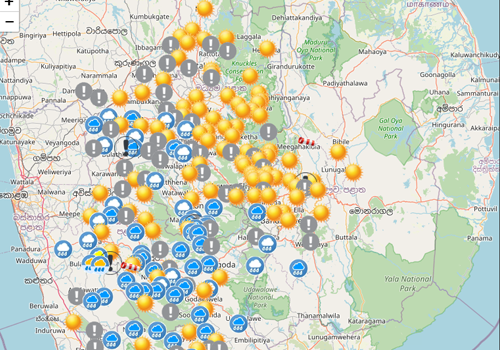
- Landslide Warnings
- Air Quality Today


Web Services
Public Services
Landslide Risk Assessment for Development
(Obtain risk assessment report for construction & development work)
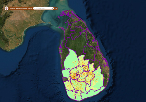
Landslide Hazard Map of Your Area
(Download landslide hazard zonation maps)
Issuing Geotechnical Clearance for Assessing the Impacts on Adjacent Structures
(Issuing Geotechnical Clearance for Assessing the Impacts on Adjacent Structures)
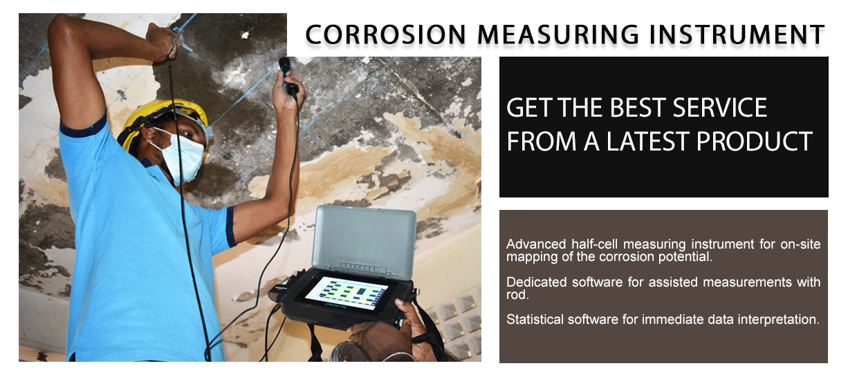
Testing & quality control of building materials
(Testing & quality control of building materials)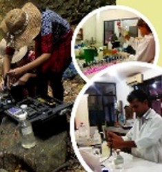
Testing of water, waste water, air quality noise & vibration
(Testing of water, waste water, air quality noise & vibration)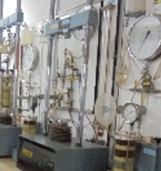
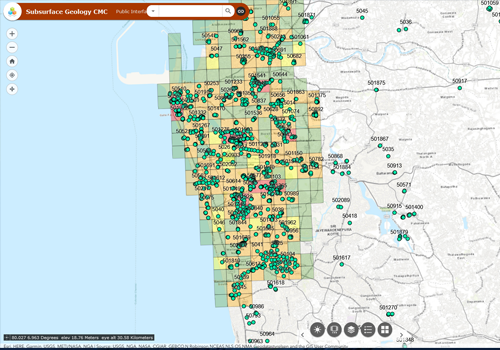
Testing of geo-technical investigations
(Testing of geo-technical investigations)
Major Projects & Programs

Landslide Risk Mitigation Program (RLVMMP)
(Reduction of landslide vulnerability by mitigation measures - RLVMMP)
International Technical Cooperation Program
(Technical cooperation between NBRO & international agencies)
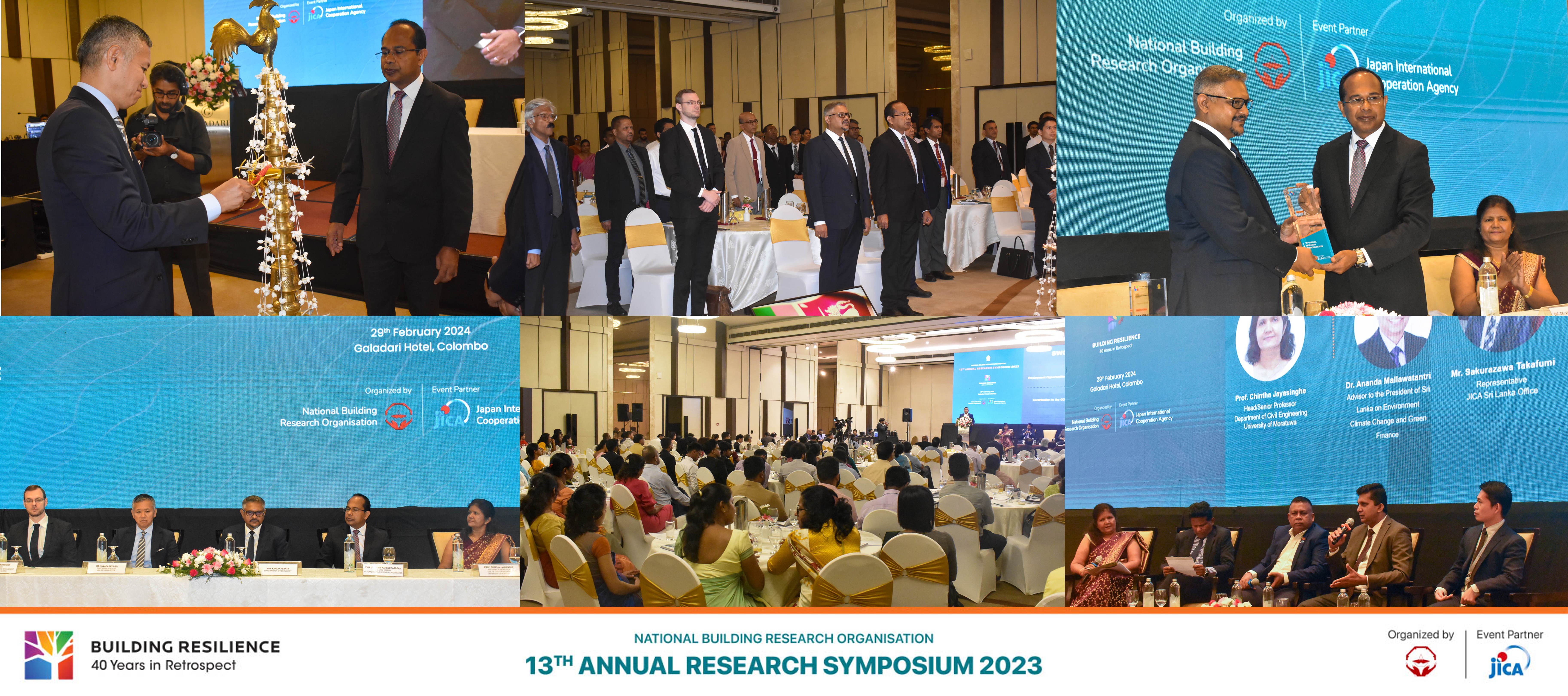
13th Annual Research Symposium 2023
(Technical cooperation between NBRO & international agencies)
Research & Development Program
(R & D updates & highlights)
Public Investment Program (PIP)
(Ongoing development projects and research executed by the Treasury funds)
SATREPS Sri Lanka Project
(SL/Japan joint project on development of early warning technology of rain induced rapid & long travel landslides)
MOBILISE Project
(Mobilise Project)
Training & Awareness Program
(Training & awareness on disaster management and resilient construction technology)
Downloads

Symposium Proceedings
NBRO Symposium publications with full text can be downloaded

Technical Guidlines
Access for Technical Guidance documents on Disaster Resilient Development

NBRO Annual Reports
Annual Report/Financial Performance Reports of NBRO

NBRO Newsletters
Quarterly Newsletter highlighting NBRO activities

Research Publications
Full Text Publications of Research and technical Papers

Special Project Reports
Technical Documents on Special Studies and projects

Tender Documents/ EOI & Vacancies
Procurement, Vacancies and EOI

Download Application Forms
Download all application forms for NBRO services

Latest News

Latest Events


News


")

Upcoming Events
Media Release

Photo Story


Latest News
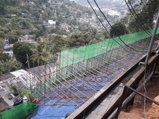
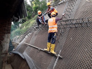
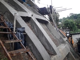
RECTIFICATION OF UNSTABLE SLOPE AND DAMAGED AUDITORIUM BUILDING OF NATIONAL INSTITUTE OF FUNDAMENTAL STUDIES (NIFS) IN KANDY
National Institute of Fundamental Studies (NIFS) is the premier institute in Sri Lanka for advancing fundamental sciences and its headquarters is located at Hanthana road, Kandy which is one of the hilly areas in the country. The Secretary, NIFS requested National Building Research Organization (NBRO) to assess the present condition and to provide mitigation measures to rectify the damaged auditorium building and to stabilize an unstable slope below the said auditorium at NIFS premises. The site is accessible through Keppetipola road and then through Hanthana Road travelling about 1.0 km from Bogambara Stadium. GPS coordinate of the site location is 7.283828N, 80.632171E. The area of concern is a recent extension of space to its auditorium, built close to a steep slope where several private houses are found along the toe of the slope. In this project, NIFS act as the employer/ funding agency while NBRO performs as the Consultant to the project. The contractor to the project is RR Constructions (Pvt.) Ltd. and the project is currently at implementation stage. Contract sum of construction work is about 137 million (excluding taxes) and project duration is 8 months.
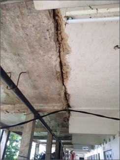
Based on the assessment conducted by the NBRO, the damages to the NIFS building can be described as follows: The main building of NIFS is located on top of the problematic slope and is oriented with its side walls parallel to the slope in South-West direction. A recent extension having a width of approximately 4 m has been constructed as a structurally separate building and joined to the main building along the slope. As a result, the distance to the edge of the slope from the building is reduced to approximately 1-2m. Foundation type is found to be individual strip footing combining two columns perpendicular to the slope. It has been used to support the extension which consists of ground floor and 2 upper floors.
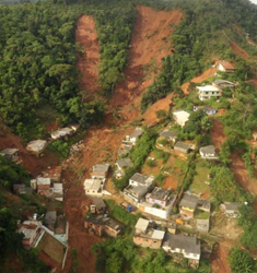
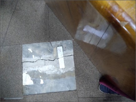
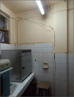
Due to the possible durability and structurally inadequacy issues, several large cracks were observed in the main building walls. The building extension has also undergone major distress with many large cracks and it has separated from the main building forming large gap in walls and floors. It was observed that the gap between the floors are greater on upper floors, indicating the building extension is slightly tilted towards the slope.
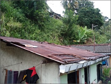
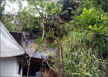
Further, as per the results of assessment, failure mechanism of slope below the auditorium building can be described as follows: As NIFS is located at a hilly terrain with its boundaries having slopes of varying slope angles. The slope under study is situated along the South West boundary of the NIFS premises with inclination of more than 70° and slope height of 5-7m. It was observed that several single storied low cost private buildings have been constructed along the toe of the slope. As observed at the site, there were several failed locations along this problematic slope segment due to unstable slope geometry and excess infiltration through the upper slope. It was also noticed, possible human activities along the toe of the slope by the occupants to extend the houses/ garden area by disturbing the slope may have contributed in destabilizing the slope further. Some of the houses have been partially damaged due to local failures occurred at upper slope.
Accordingly, NBRO carried out a detailed geotechnical investigation to gather subsurface formation and properties of subsoil. Further, geological survey was conducted to collect geological features in the problematic area. Based on the information gathered during site visits, geotechnical investigation, geological mapping, and related analysis, NBRO carried out a detailed design with appropriate mitigation measures to stabilize the unstable slope near NIFS premises. Consequently, proposed mitigation measures for stabilizing unstable slope below the auditorium building are soil nailing, reshaping and drainage improvement including surface and subsurface drains. These mitigation works are currently carried out at the site with the physical progress over 50%.
Damaged auditorium building is proposed to rectify using retrofitting techniques of strengthening of structural elements of building such as beams, columns and slab as necessary. Finalizing works of structural recommendation is currently underway for commencing tendering works.
M.H.M. Harshani, W.R.A.U. Dilrukshi, K.N.Bandara
Geotechnical Engineering Division
NBRO Involvement in Managing Disaster Risk on Incidental Fires at Chemical Industries
With the development of the world’s industrialization and the increasing population, the chemical industry is booming, the chemical plant accidents continue to rise rapidly, Sri Lanka is no exception and has been experiencing chemical disasters. The very recent examples are fires that broke out at “Global Care Products”, Kandana and “Watercare Technologies (Pvt) Ltd”, Homagama on 8th August 2023, and 17th August 2023 respectively. Both industries have used flammable and volatile chemicals with low flash points as raw materials in their manufacturing processes. The main danger from smoke is reduced visibility. Smoke and toxic gases and vapours generated during a fire are responsible for the harmful effects such as respiration difficulties, and mild irritation of the eyes, nose and skin.
As a multi-disciplinary technical service provider functions under the Disaster Management division of the Ministry of Defense, the National Building Research Organisation (NBRO) was informed by the Central Environmental Authority (CEA) and Disaster Management Center (DMC) of both of these incidents. Consequently, a team headed by the Director of the Environmental Studies and Services Division reached the location immediately in each case and monitored gas concentrations to identify the risk levels for the safety of surrounding communities, and were reported to relevant authorities and responsible institutes for immediate action since the actions taken in the initial minutes of an emergency are critical in saving lives and safeguarding the livelihoods of vulnerable people.
These chemical fire incidents in Sri Lanka shed light on both the progress made and the challenges that remain in ensuring effective chemical fire safety and emergency response and emphasize a national chemical emergency coordinating structure, including appropriately trained staff with the right knowledge and skills for dealing with each of the stages of the disaster cycle.
WKN Chandrasena
Civil Engineer
Environmental Studies & Services Division
National Building Research Organisation
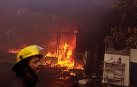
Figure 1: Fire breaks out at Global Care Products, Kandana
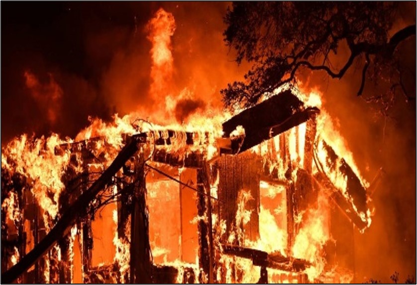
Figure 2: Fire breaks out at Watercare Technologies (Pvt) Ltd, Homagama
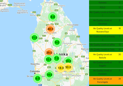
දෛනික වායු ගුණ තත්ත්ව වාර්තාව - 2023.03.03
අද දින උදෑසන 08.00 ට පැවති වායු ගුණ තත්ත්වය සැලකීමේදී, දිවයිනේ බොහෝ නගරවල ශුද්ර අංශු (PM2.5) ප්රමාණය US AQI, 101-150 අගයක පවතින අතර මෙම තත්ත්වය හේතුවෙන් සංවේදී පුද්ගලයන්ට සෞඛ්යමය වශයෙන් යම් යම් අපහසුතාවයන් ඇති විය හැක. කෑගල්ල, නුවරඑළිය, ඇඹිලිපිටිය, පුත්තලම හා කළුතර යන නගරවල පමණක් වායු ගුණ තත්ත්ව දර්ශකය, මධ්යයම (US AQI 51-100) තත්ත්වයක් පෙන්නුම් කරයි. මෙම තත්ත්වය කාලගුණික තත්ත්වයන් මත විටින් විට වෙනස්විය හැකි අතර අද දින පස්වරුව වන විට මෙම වායු දූෂණ තත්ත්වය තරමක් අඩු විය හැකි යයි බලාපොරොත්තුවේ.

Issuing Geotechnical Clearance for Assessing the Impacts on Adjacent Structures
|
National Building Research Organisation (NBRO) receives requests from developers for their building construction activities through Project Approving Agencies such as Urban Development Authority (UDA), Department of, Coast Conservation and Coastal Resource Management (CCD), Central Environmental Authority (CEA) and Sri Lanka Tourism Development Authority (SLTDA) for obtaining a clearance from NBRO for the proposed development activities including pilling and deep excavation. The main objective the clearance is to assess the impacts of a particular proposed development to adjacent properties and surrounding environment especially during the construction of the building. The requirement is enacted by the UDA as per their newly published Gazette. |
|
The clearance of NBRO is a written statement with comments issued to a developer who submits the request to NBRO, including completed required documents. |
|
This Standard Operating Procedure (SOP) was developed by NBRO to standardize the activities performed under the Geotechnical Clearances Process. This document will provide step by step procedure for each and every activities of the programme. |
STAGES OF THE APPLICATION |
| There are three main types of clearances; |


